
One doesn’t generally associate the borderlands of Delaware, Maryland, and Pennsylvania with vast wild spaces. The region is mostly rural, but the farms aren’t huge, and they’re interspersed with housing developments. It is, I say from personal experience, very difficult to get more than a mile from a major road. Being situated along the southern edge of the Appalachian Piedmont, the area is hilly…but they’re little hills. Don’t get me wrong, they’re very pretty hills, but the foothills of the Himalayas they are not.
This makes it all the more remarkable that this aesthetically tame little corner of the world should contain over 13000 acres of protected and almost-contiguous natural land open to the public, distributed between Fair Hill Natural Resource Management Area (NRMA) in Maryland, White Clay Creek State Park and Middle Run Natural Area in Delaware, and White Clay Creek Preserve in Pennsylvania. And while 13000 acres probably doesn’t sound like much if you come from, I don’t know, Montana, for someone from Northern Delaware 13000 acres of undeveloped open space is virtually unheard of outside of impenetrable coastal salt marshes.

8000 of these acres straddle the Mason Dixon Line, with Fair Hill NRMA and the ungainly titled Big Elk Creek Unit of White Clay Creek State Preserve forming a great swath of parkland, one of the largest in the region. And this swath has grown quite a bit in only the last few years. The state of Pennsylvania has owned a large tract of land bordering Fair Hill NRMA between the Mason Dixon Line and Strikersville Road (see map below) since 2010, which it administered as part of White Clay Creek Preserve (not to be confused with White Clay Creek State Park, Delaware…there’s a lot of creeks where I live). But in 2020, another 1000 acres of parkland was appended to the Big Elk Creek Unit through a land deal orchestrated by The Conservation Fund and The Mt. Cuba Center.
Since it contains something like 70 miles of trails, Fair Hill NRMA in Maryland has been on the radar of Mid-Atlantic outdoor enthusiasts for quite some time. But the Big Elk Creek unit sees far less visitation. I think this is both because it’s still very obscure (nobody searching for White Clay Creek is actually searching for Big Elk Creek), and is still, at least by Mid-Atlantic state park standards, virtually undeveloped.
The new land, until recently owned by one of the board members of the Campbell’s Soup corporation, has only two real access corridors: The Mt. Olivet Road, which can be accessed from Strikersville Road and leads along the eastern edge of the parkland, and the Woodlawn Trail, a gentle, pleasant walk along the southwestern bank of Big Elk Creek. This leaves most of the land without well-established trails of the sort one finds a short way to the south in Fair Hill.
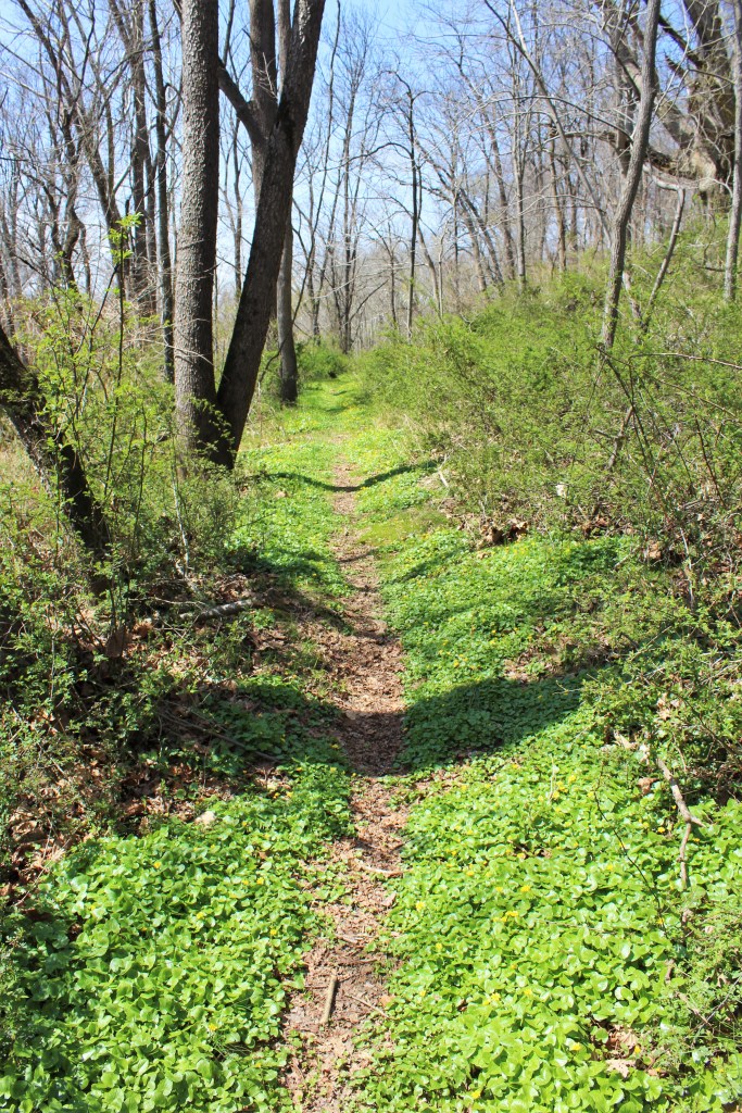
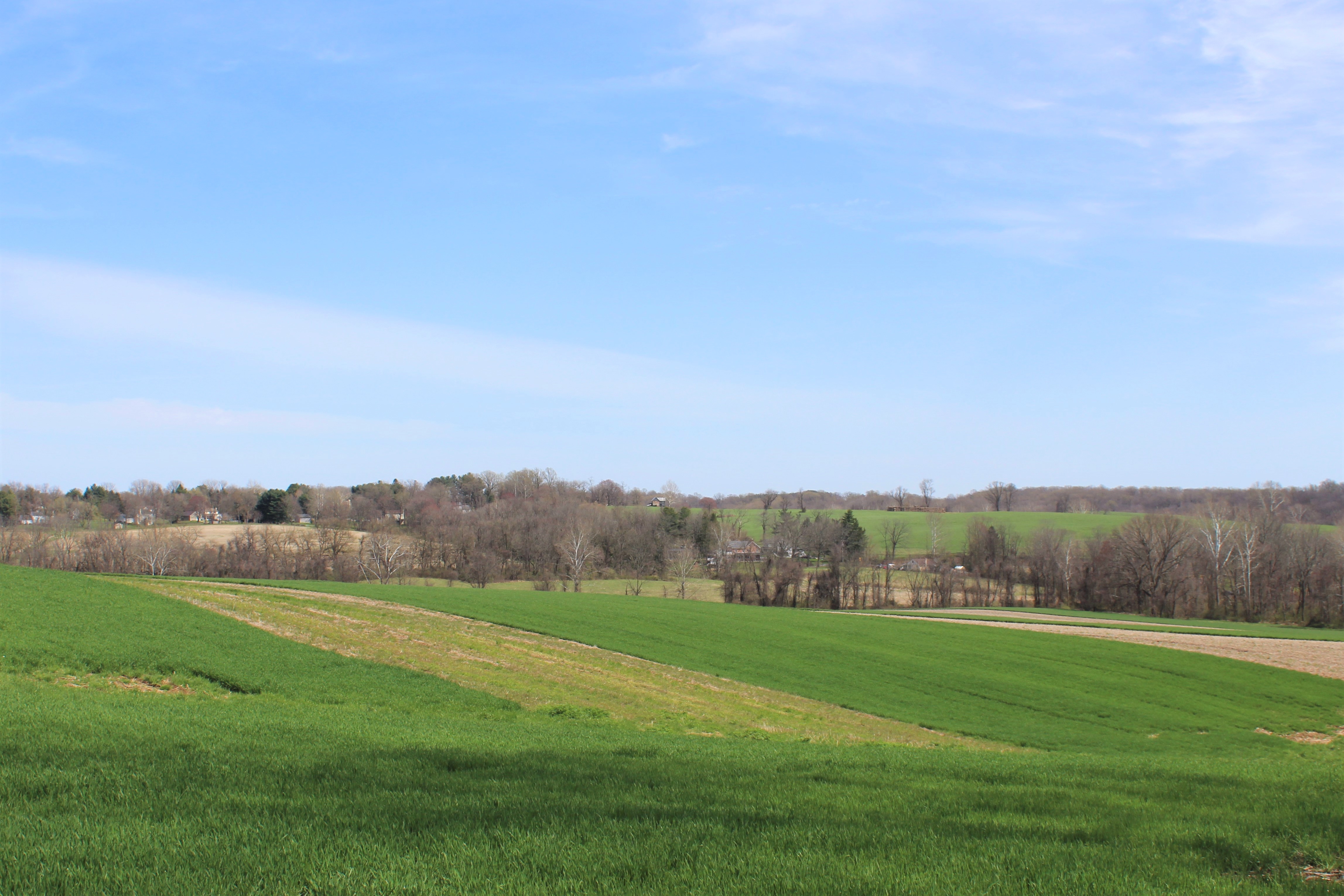
But that doesn’t mean it’s impossible to explore the Big Elk Creek Unit. There are pathways around the edges of the area’s fields, and in the woods along the creek there are game trails and faint tracks. It’s not a place where you’d want to go mountain biking, but in terms of the scenery, it’s just a beautiful as anywhere else in the wilds of the Delaware, Maryland, and Pennsylvania borderlands…just far less accessible.

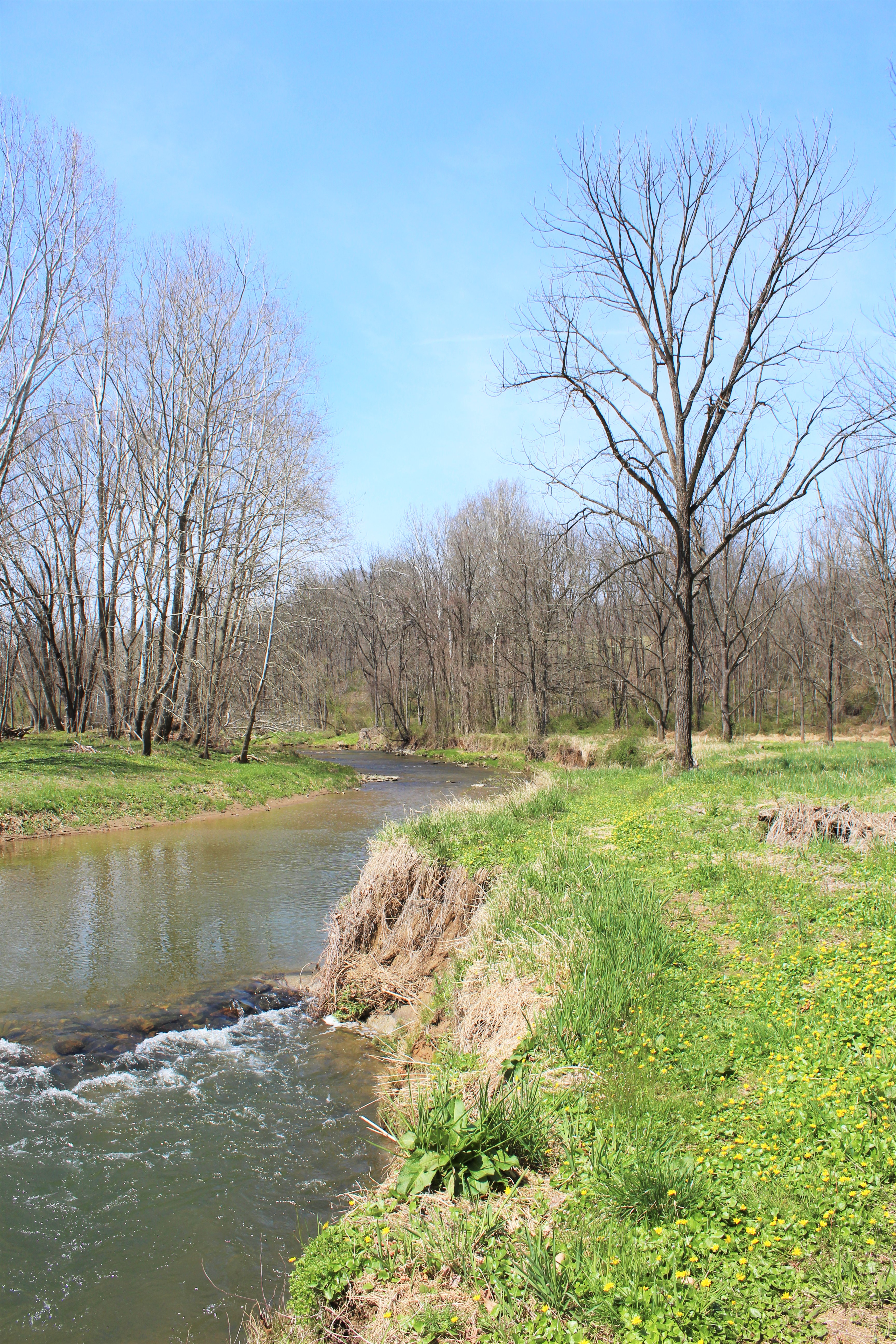
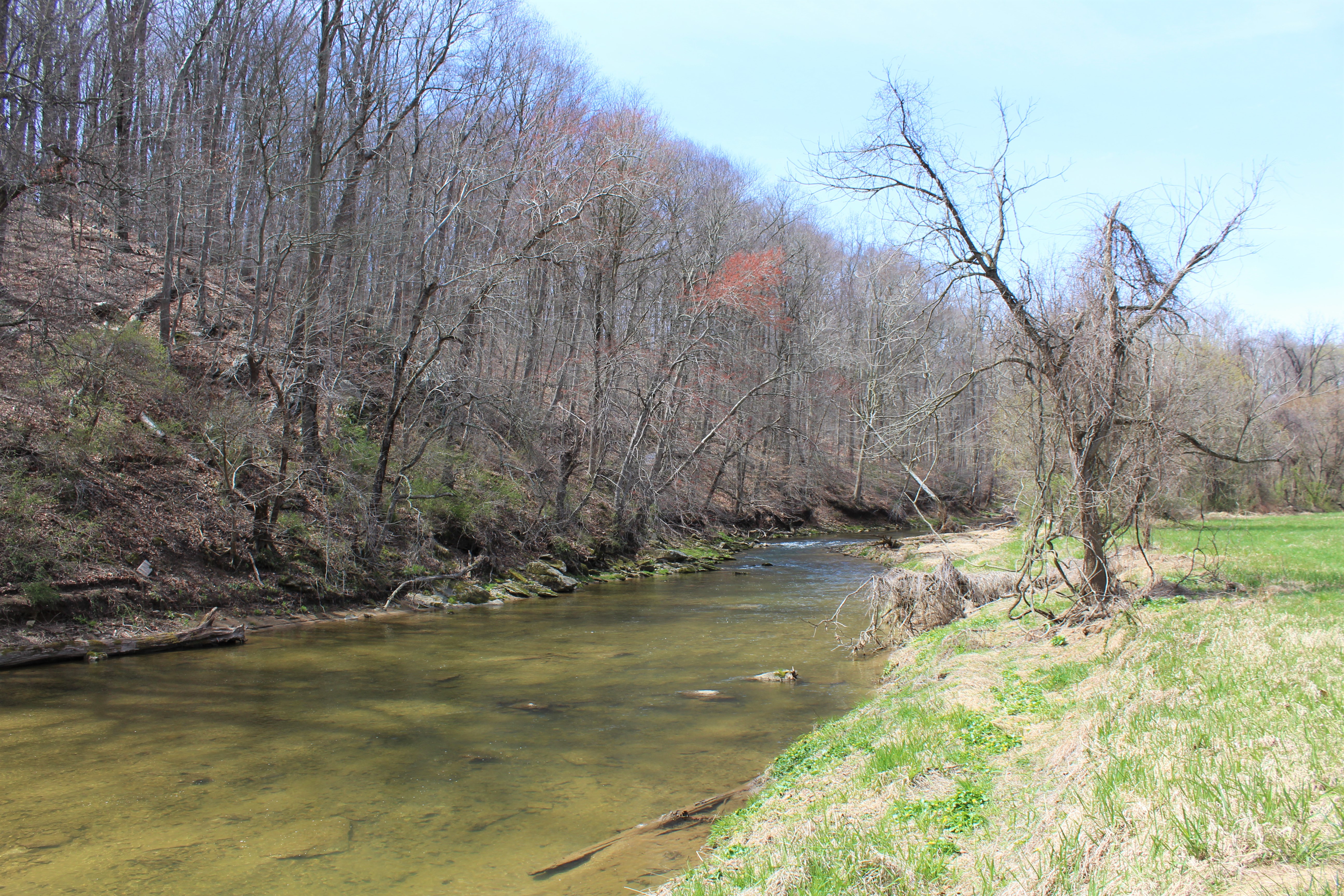
The map above gives a rough outline of a walk I took through the Big Elk Creek Unit in early April 2022. I started at the small parking lot on Strikersville Road and then headed down that road to the Mt. Olivet Road, which is before you cross Big Elk Creek. Note: The Mt. Olivet Road is closed to traffic
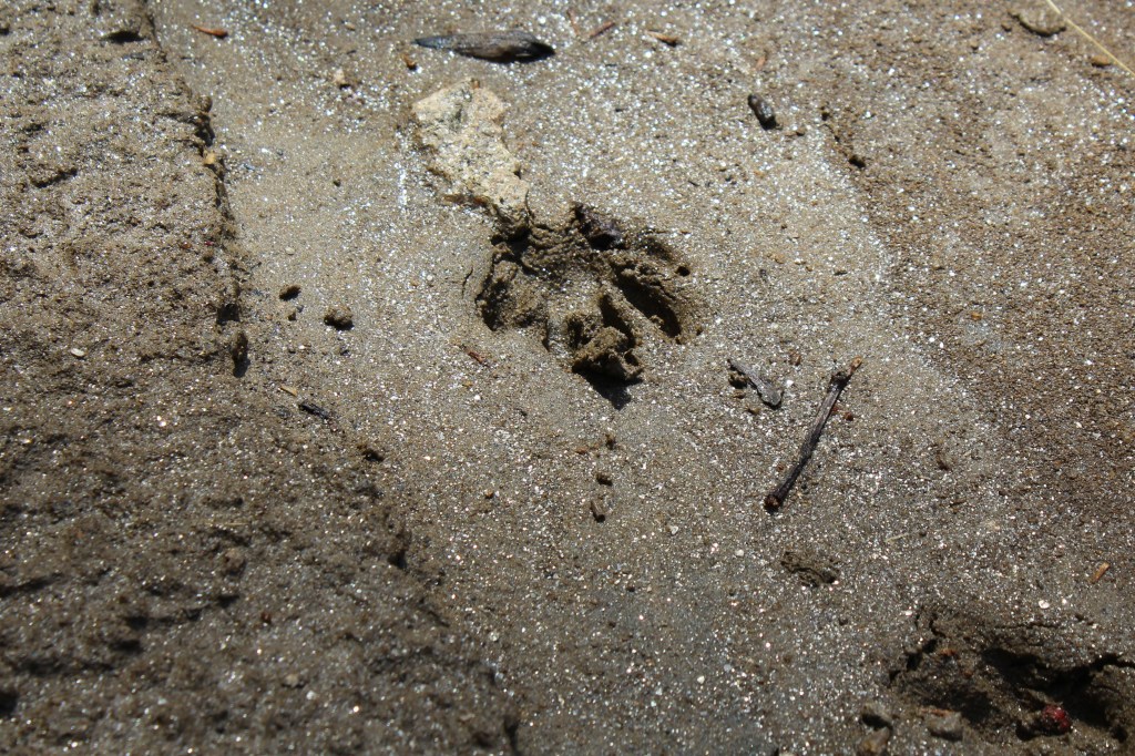
Once I got a little way up, I simply turned left on the first semi-passable looking path into the fields to the west of the Mt. Olivet Road and then followed the northeastern bank of Big Elk Creek as best I could. Most of the way there were fairly well-established deer tracks (and judging by the prints, plenty of foxes and raccoons were using them too). There were also some faint paths leading along the base of the hills to the north of the creek that looked like they had probably been there since before the property was handed over to the state.

But the undergrowth hadn’t come in yet. I don’t think it would be possible to take this walk in the Late Spring/Summer…unless one was super determined and didn’t mind thorns, poison nettles, and tics…but whatever floats your boat…
In short, I’m not sure what I did was really the most efficient way to explore this area.

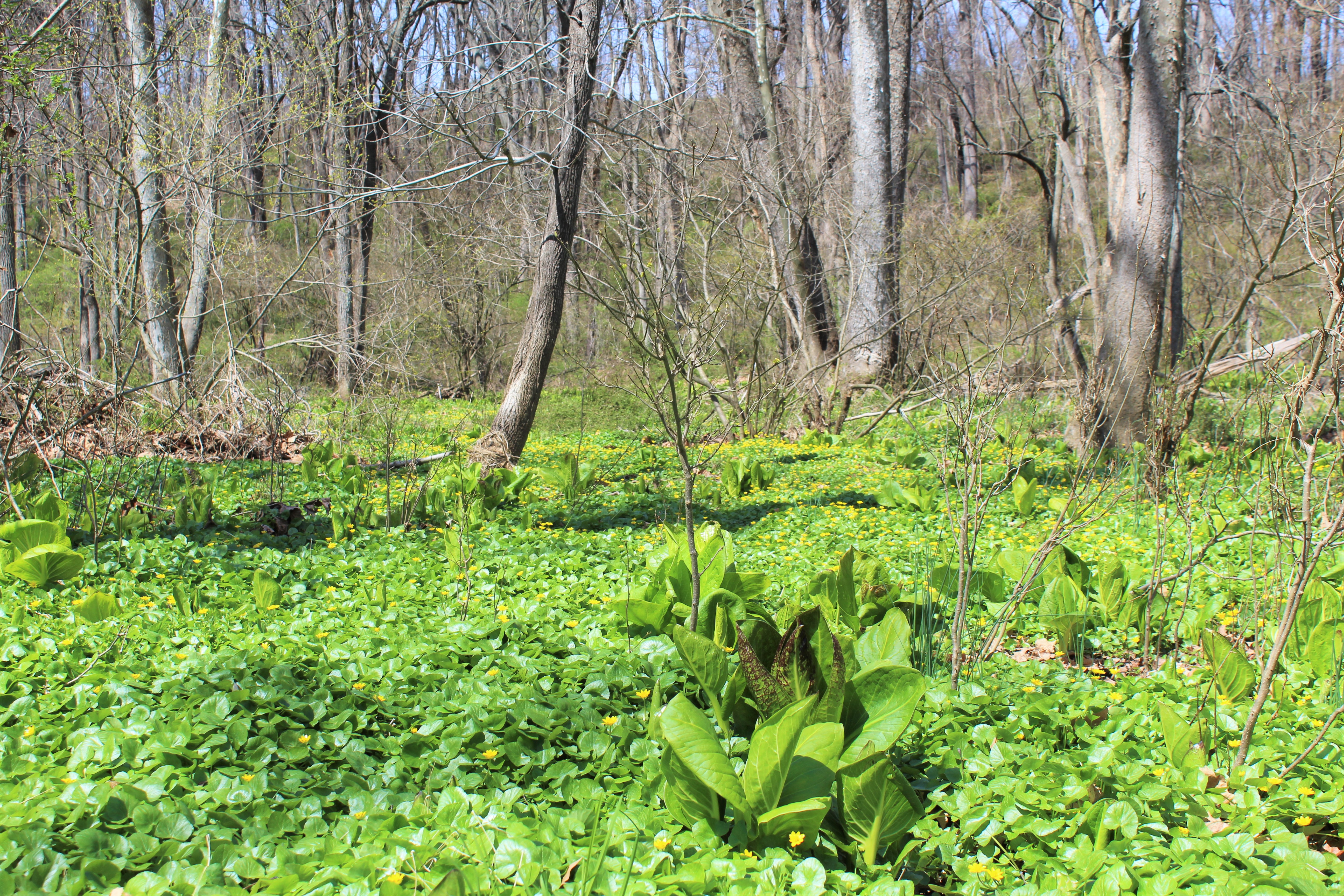
It having been very early spring when I took this expedition, the floodplains along Big Elk Creek were completely covered in a carpet of lesser celandine and big leafy skunk cabbages. These both tend to appear much sooner than most of the other undergrowth in the area. Sometimes the skunk cabbages are going strong as early as late February.
While the lesser celandine is visually quite attractive, it’s sadly also invasive. It blooms early, mostly along river floodplains, and then covers as much space as it can to the detriment of native flowers that might have been coming up a few weeks later.

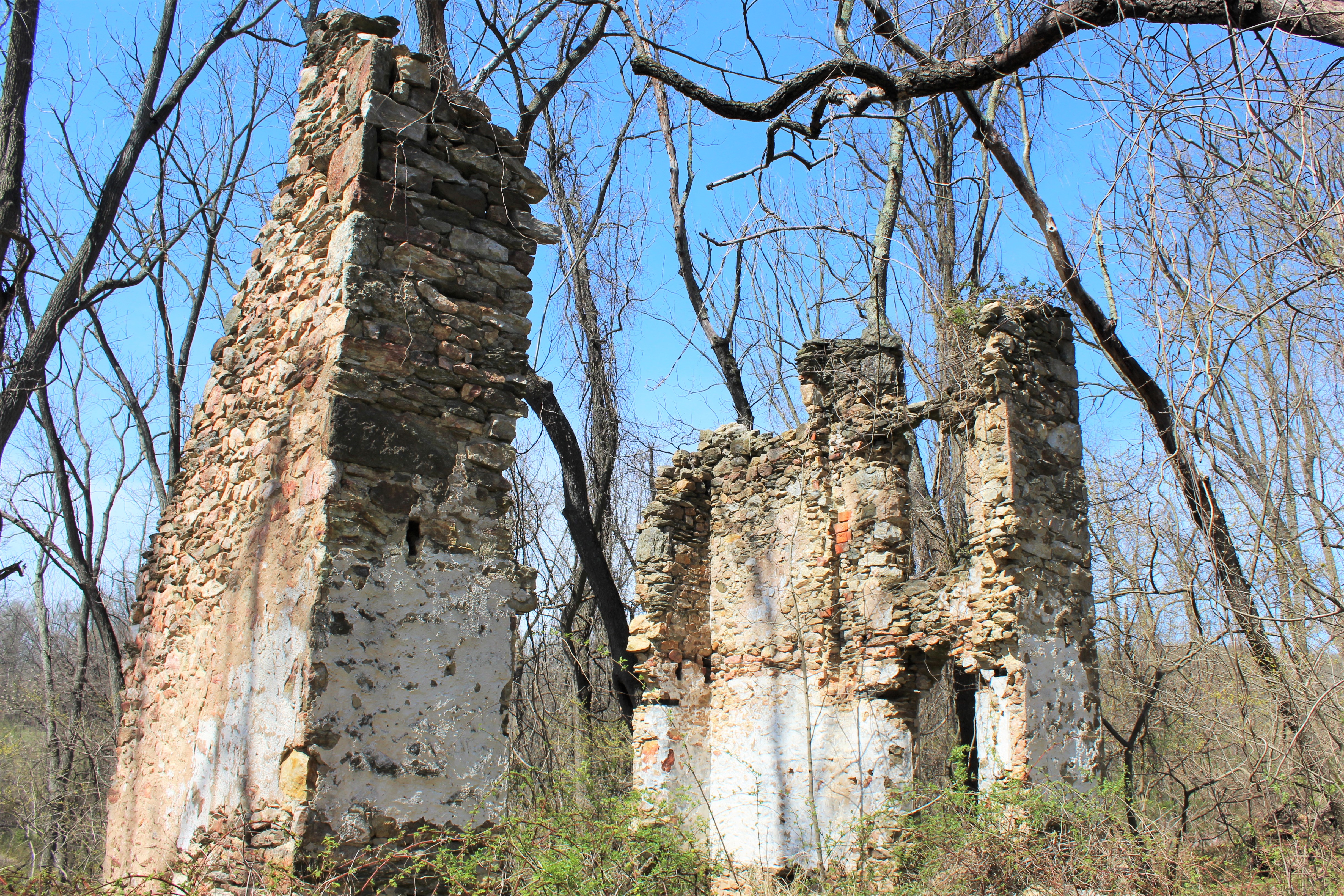
Even with all the development of recent decades, the forests of the Delaware, Maryland, and Pennsylvania borderlands remain full of the ghosts of an earlier period in history. One of the most interesting things about exploring the woods of Fair Hill and White Clay Creek is stumbling upon the ruins of old farmhouses, many of which are from a time when there would have been far fewer trees and the land would have been under more intense cultivation.
Plenty of the old structures in Fair Hill and White Clay Creek Preserve are well documented historical sites. But there are also quite a few ruins out in the woods that are being allowed to crumble away into obscurity.
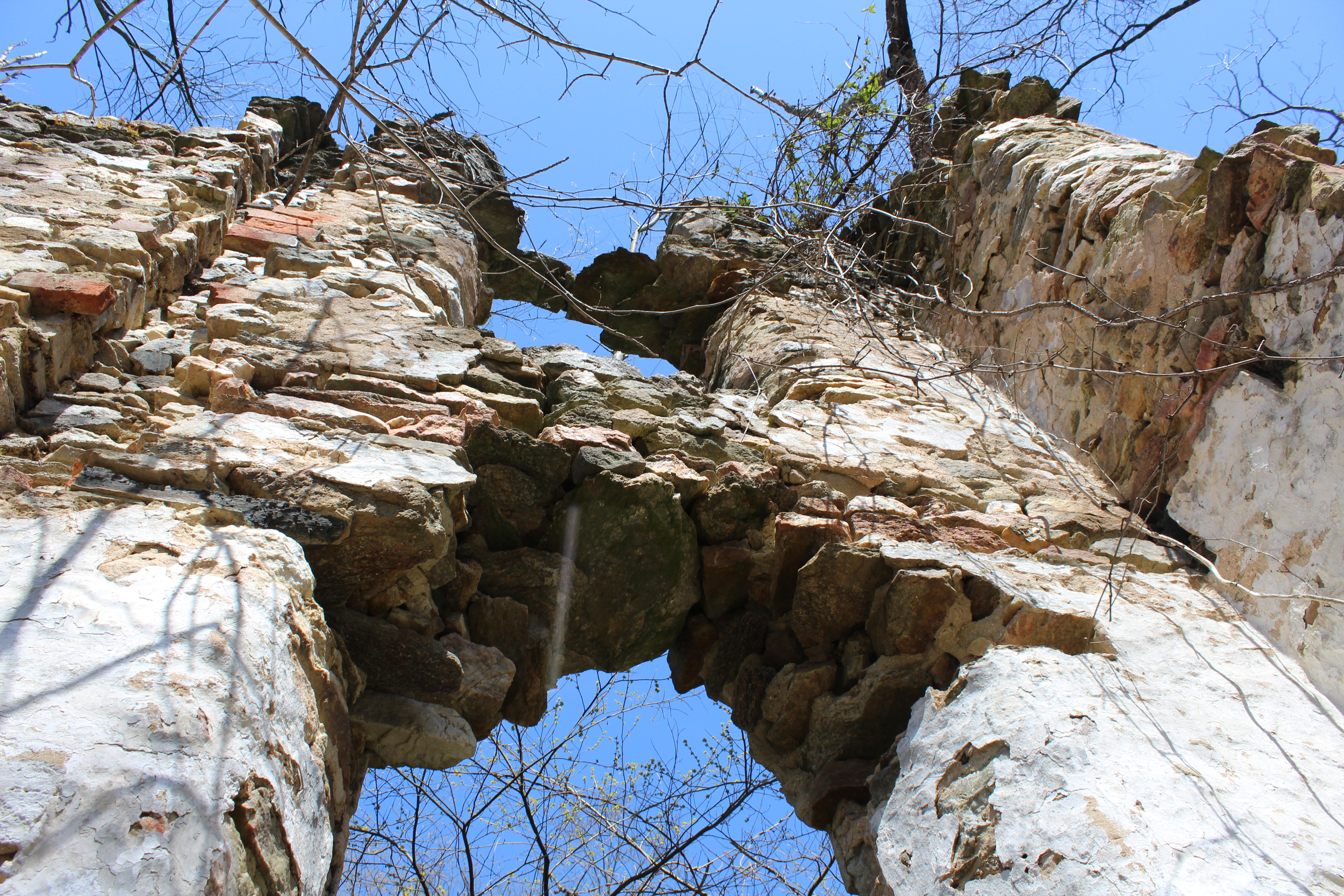
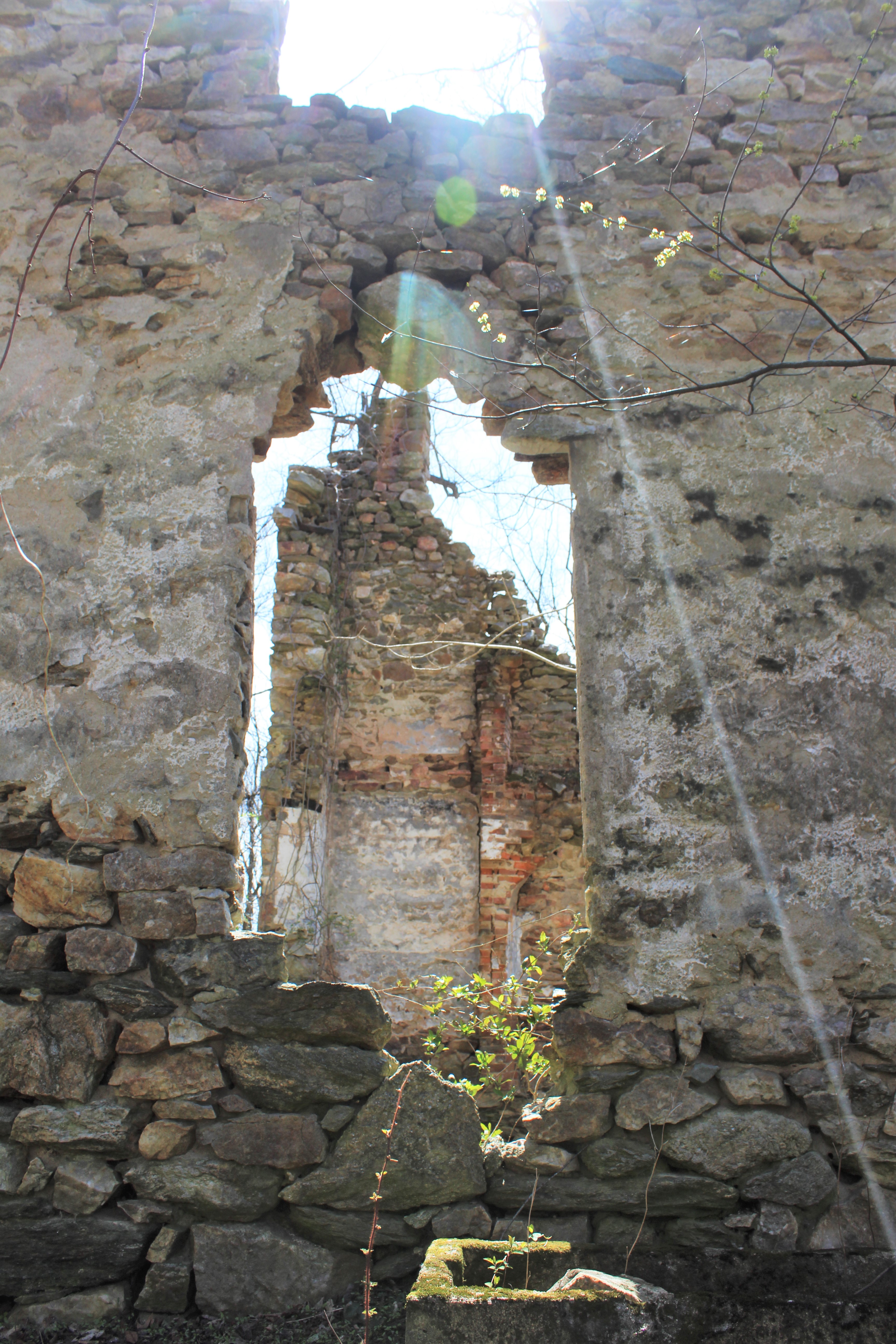
As I was making my way back from the river, I decided to climb up onto the hills above it and head overland east across some open fields towards the Mt. Olivet Road. As I was walking along a tree line, I happened to hear a vulture squawk way off in the woods to my right. Looking that way, I could just barely make out a giant black bird perched atop an old stone wall, which was part of a large ruin. Even in the early spring with the leaves still off the trees, the stone wall was hard to see. Were I to walk past the same spot a few weeks later, the ruin would have been completely hidden by foliage, as it must always be between late April and November.
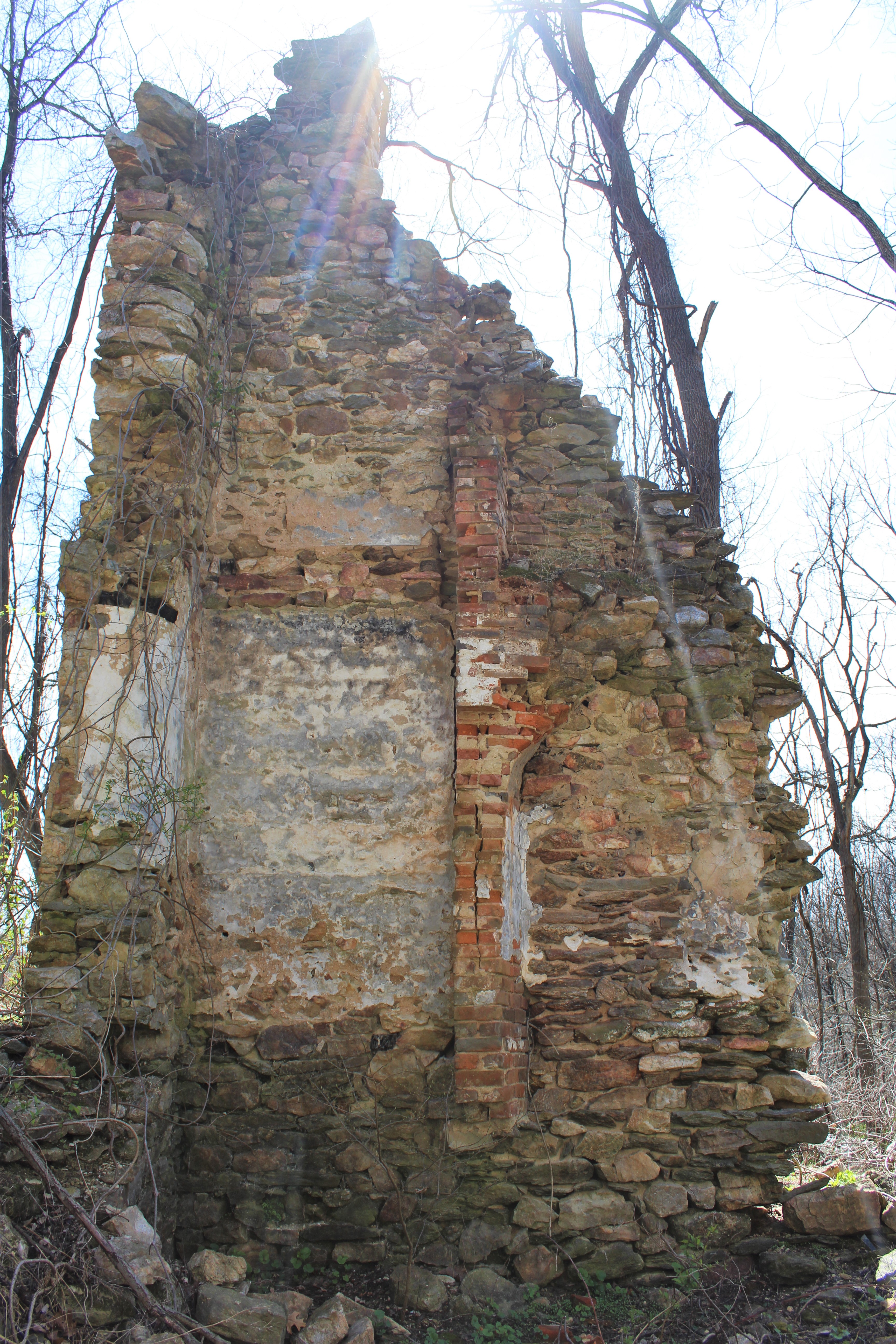
I have no idea what the history is behind this ruin, including how recently it was deserted. Sometimes structures that seem like they should have been unoccupied for centuries turn out to have been abandoned only in the recent past. For example, I had no idea that the now derelict Evan’s House in the main unit of White Clay Creek Preserve was still occupied as late as the 1990s.
But what I can say is that, judging by the piles of stone and plaster all over the ground, the obscure ruin in the Elk Creek section of the preserve is not going to be with us much longer.
I’d be interested if anyone has more information on this. I’ve marked the approximate location of the ruin on the map, though bear in mind that the pin is probably off by a few feet.
I’m not sure what plans, if any, the Pennsylvania Department of Conservation and Natural Resources has for the Big Elk Creek Unit. A better parking situation and more trails would be nice, but, then again, it’s oddly comforting to have a big swath of wild land nearby when you live in a place as built up as Northern Delaware. I won’t hold it against them if they make the Big Elk Creek Unit more visitor friendly. But there’s no rush.
If you enjoyed this post, please consider supporting me on my Patreon page. There, you can download [BEGINNING JULY 2022!] a new extended edition of my book The Green Unknown: Travels in the Khasi Hills which includes several chapters available exclusively on Patreon, as well as access lots of other perks.

2 thoughts on “THE WILDS OF BIG ELK CREEK”