Author of The Green Unknown: Travels in the Khasi Hills
SUSPENSION BRIDGES OF MEGHALAYA: PART 3
Now for the third and final post of my series on the Khasi Hills’ architecturally unexceptional, yet inarguably scenic, steel and concrete footbridges.
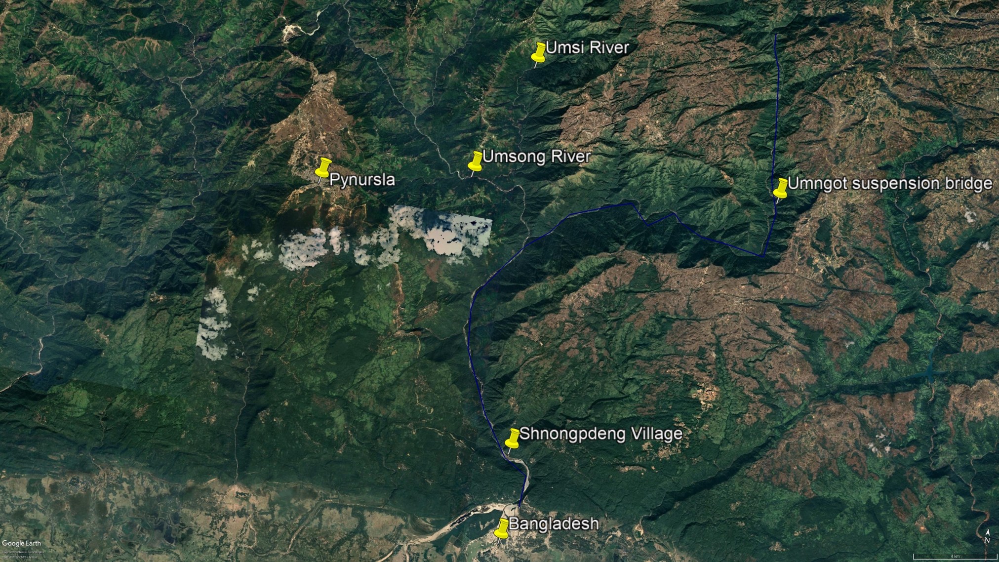
Today I’ll be covering just a fraction of the conventional bridges found within the vast system of remote interconnected gorges that make up the basin of the mighty Umngot River.
As I’ve written in my upcoming book Through the Canyons of Living Bridges: “The Umngot enters Bangladesh next to the border town of Dawki. Upstream from that culturally mixed settlement that straddles two nations, the river cuts a long, crescent-shaped gorge that bends slightly to the northeast. There are a few significant tributaries of the river at this point, such as the Amkshar and Padu streams which flow into it from the east, though these only produce short, deep-but-narrow canyons, which are mere interruptions in the tableland rather than whole landscapes of their own.
“The contrast between the lower and upper Umngot gorge couldn’t be greater. Not far below the village of Nongkwai, the river makes an abrupt eastward turn and runs through an immense chasm for a few kilometers. Then it curves sharply to the north again and climbs to its cool headwaters atop the Shillong Plateau. To the west of the first sudden turn, several major tributaries merge and then meet the Umngot. These gouge a succession of huge, parallel, north-south running canyons. Several villages cling to the tops of the thin ridges that divide these gorges, and trails and very recently constructed roads lead along the crests.”
For my previous two entries on the scenic suspension bridges of the Khasi Hills, check out the posts below:
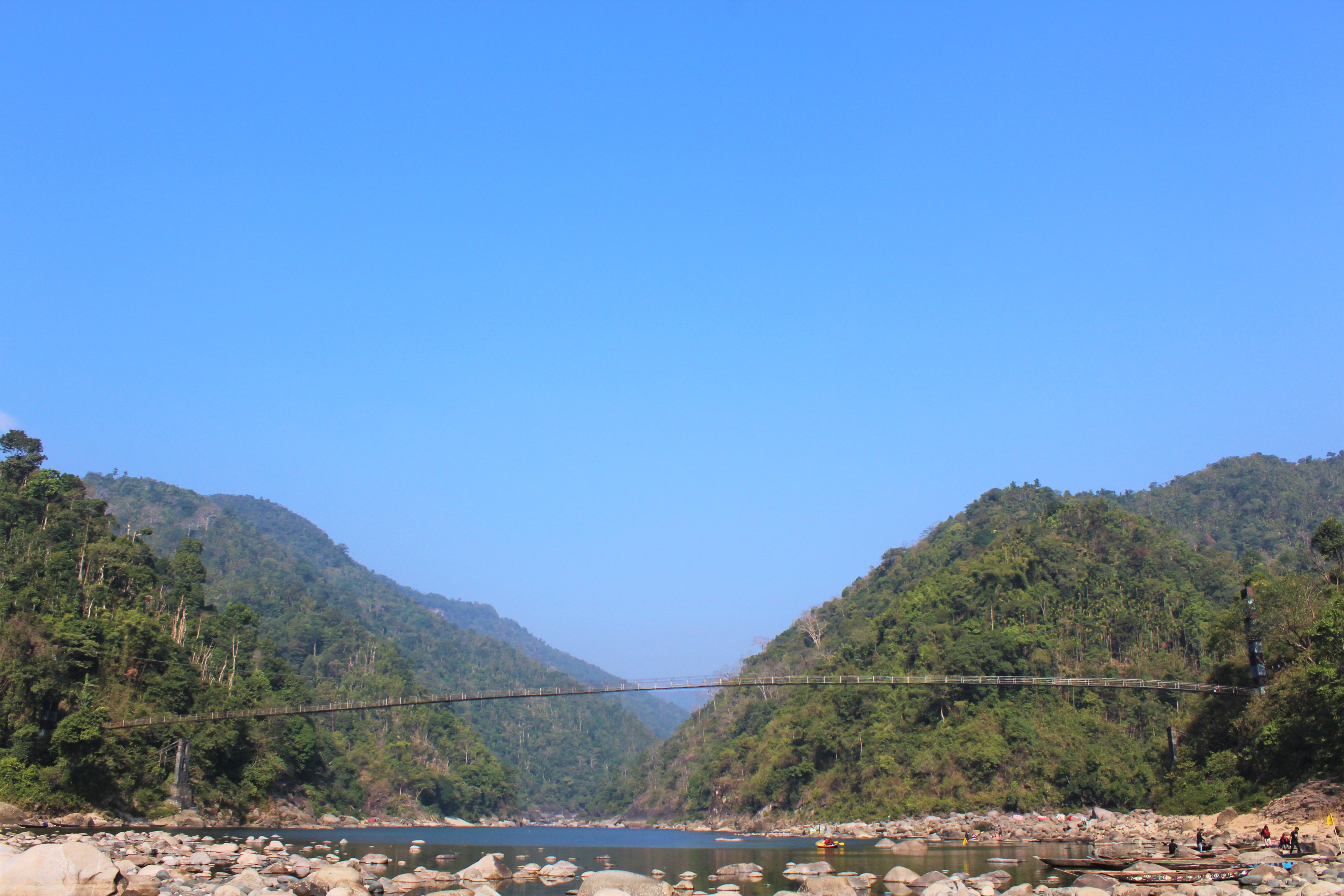
Parts of this region are far from obscure. The border town of Dawki, and the lovely village of Shnongpdeng nearby, are both firmly on Meghalaya’s tourism map. And Shnongpdeng has what is perhaps the most iconic steel-and-concrete suspension footbridge in all of Meghalaya, a 170 m span that crosses the Umngot in its lower, wider, reaches, only a few kilometers from where the river spills out onto the plains of Bengal and becomes a tributary of the muddy streams of Bangladesh as they wind down to the Indian Ocean.
Map of the Umngot River Basin
However, upstream from Shnongpdeng is a wild, remote, swath of extraordinarily difficult canyon country that was almost completely untraveled, at least as of the last time I visited (which admittedly, due to covid and sundry other issues, was a few years ago). In 2019 I trekked through the basin of the Umngot, crossing several obscure side-canyons before hiking across the primary canyon of the river through an incredibly beautiful, though also rarely visited, stony gorge. There were several steel and concrete footbridges on the way, along with the occasional rumor or faint recollection of living architecture that had since disappeared.
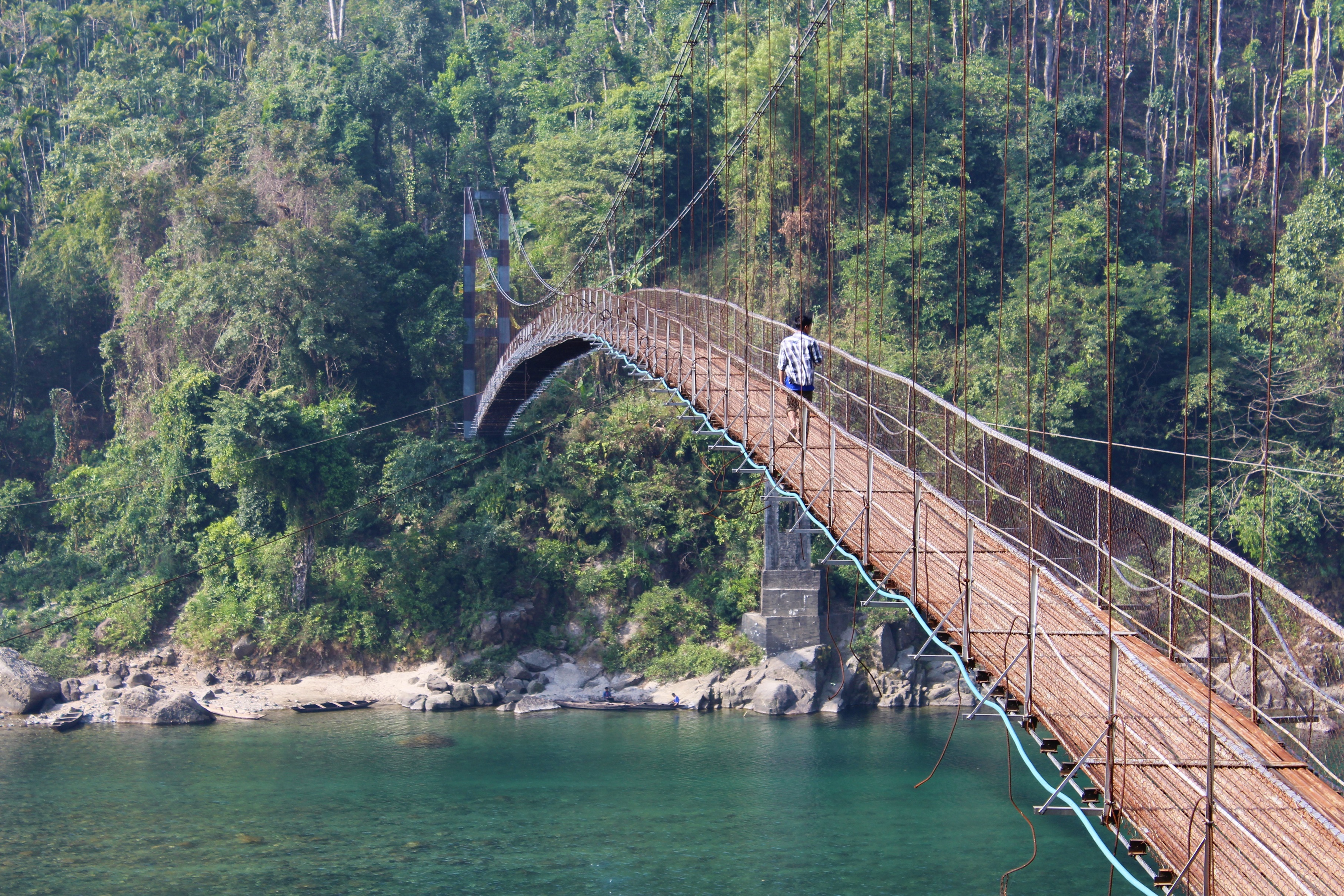
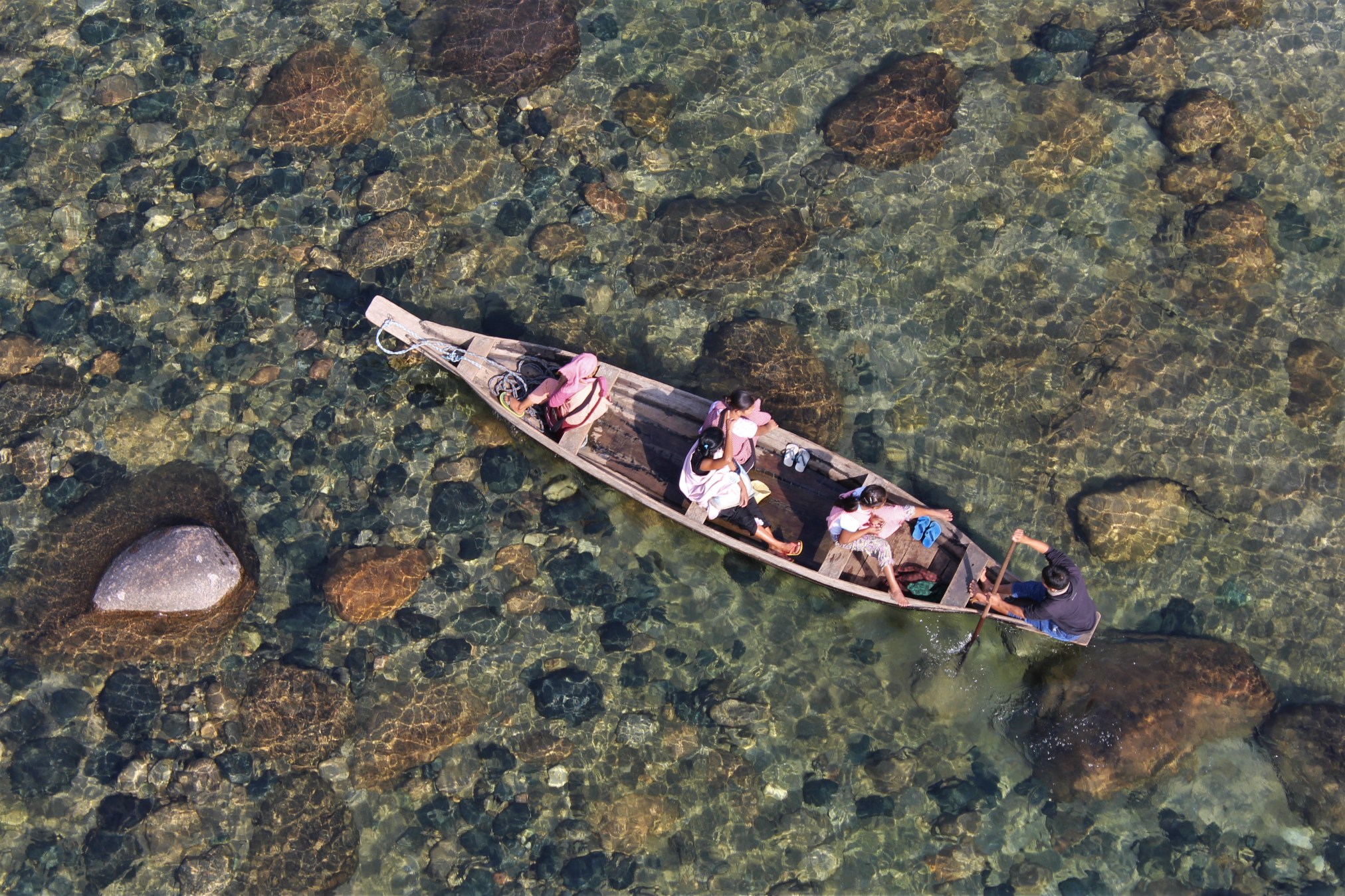
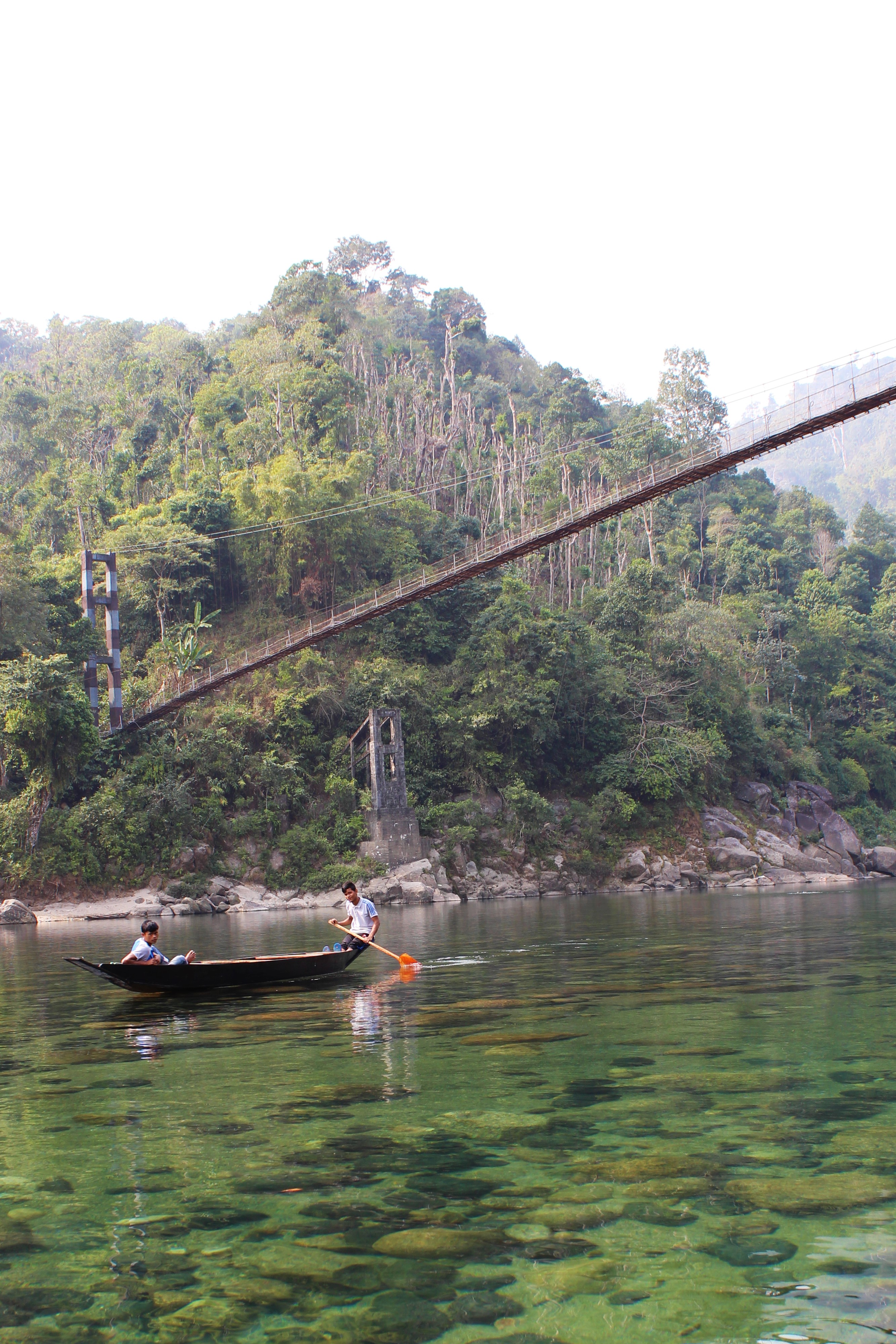
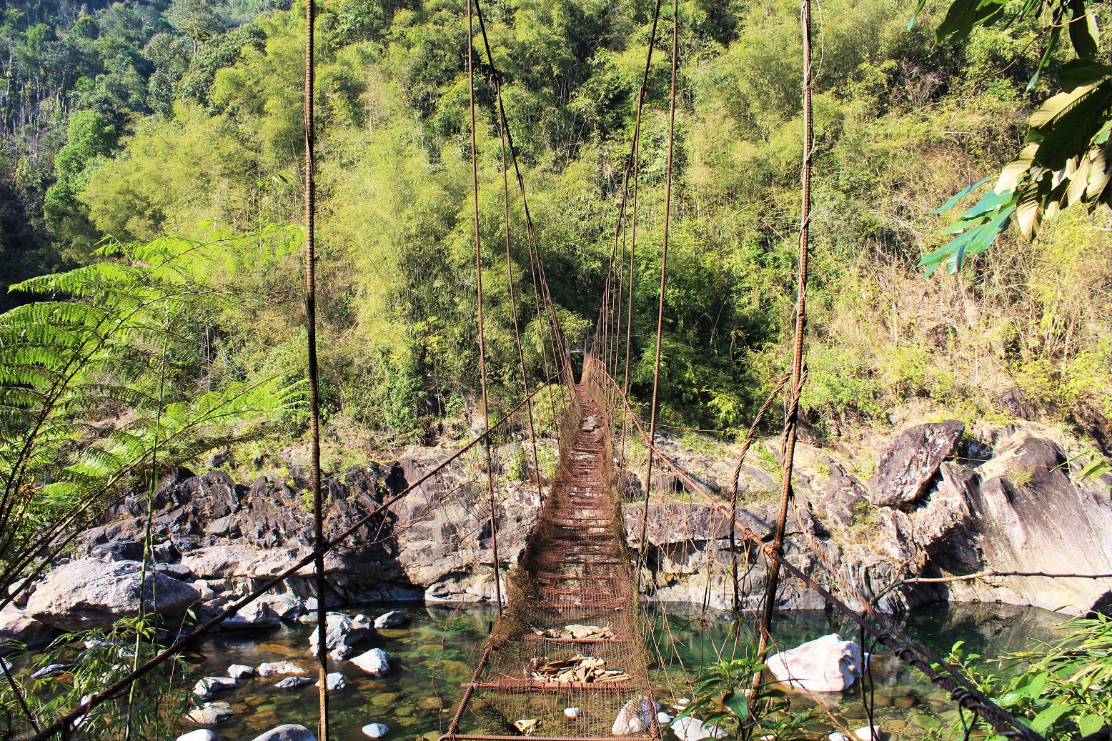
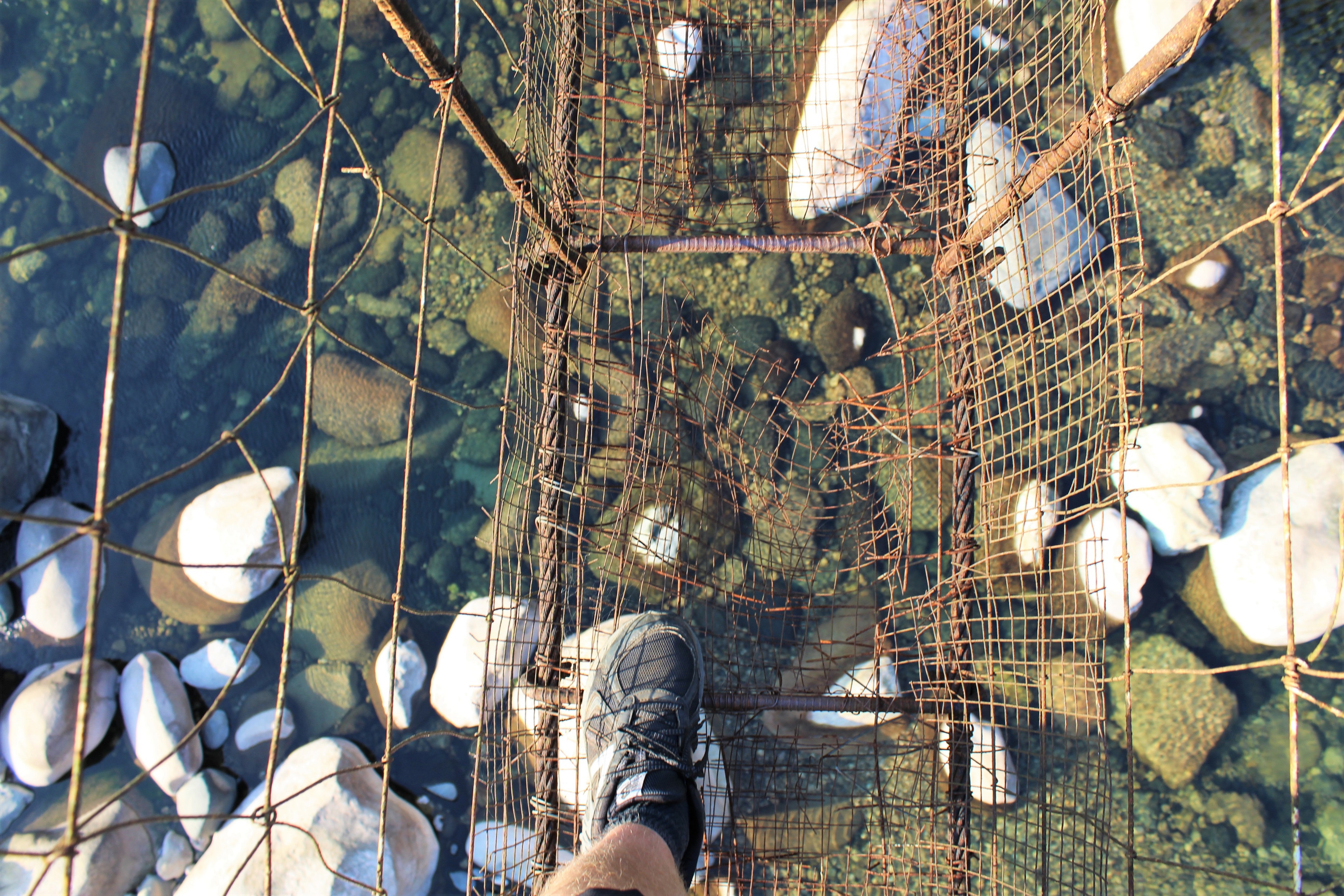
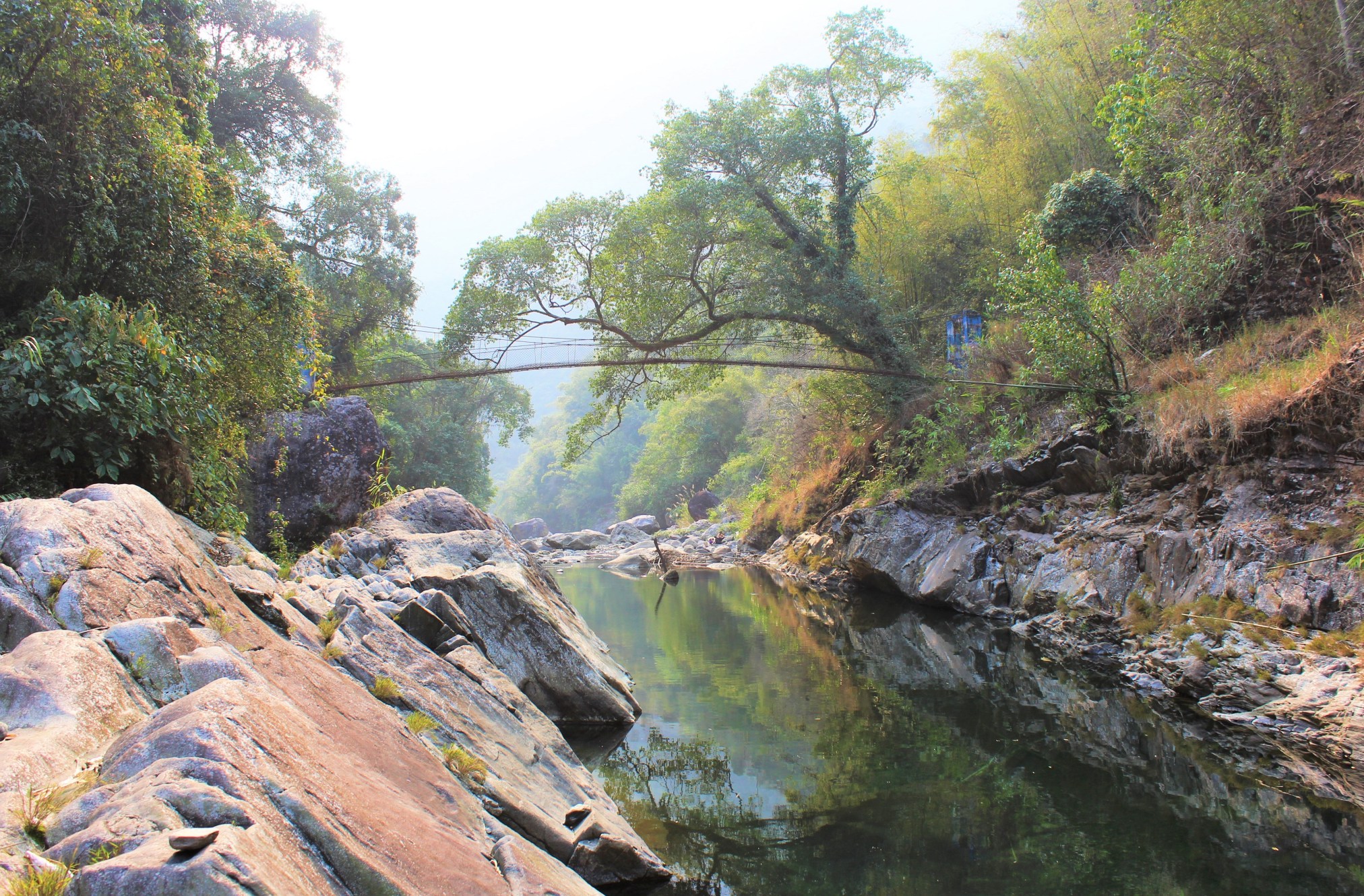
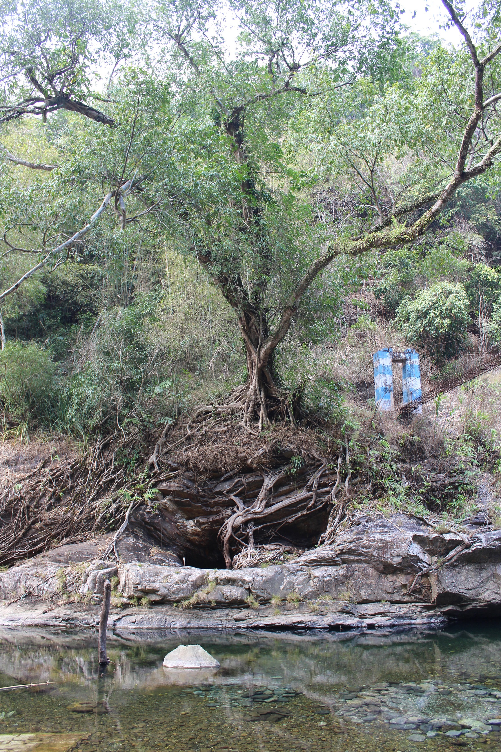
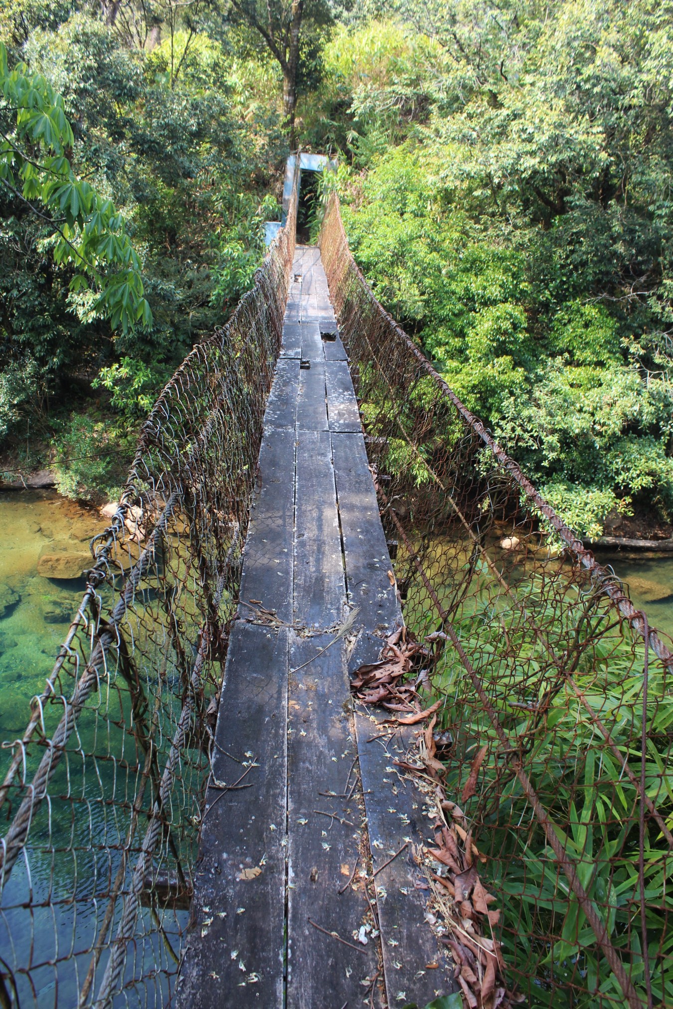
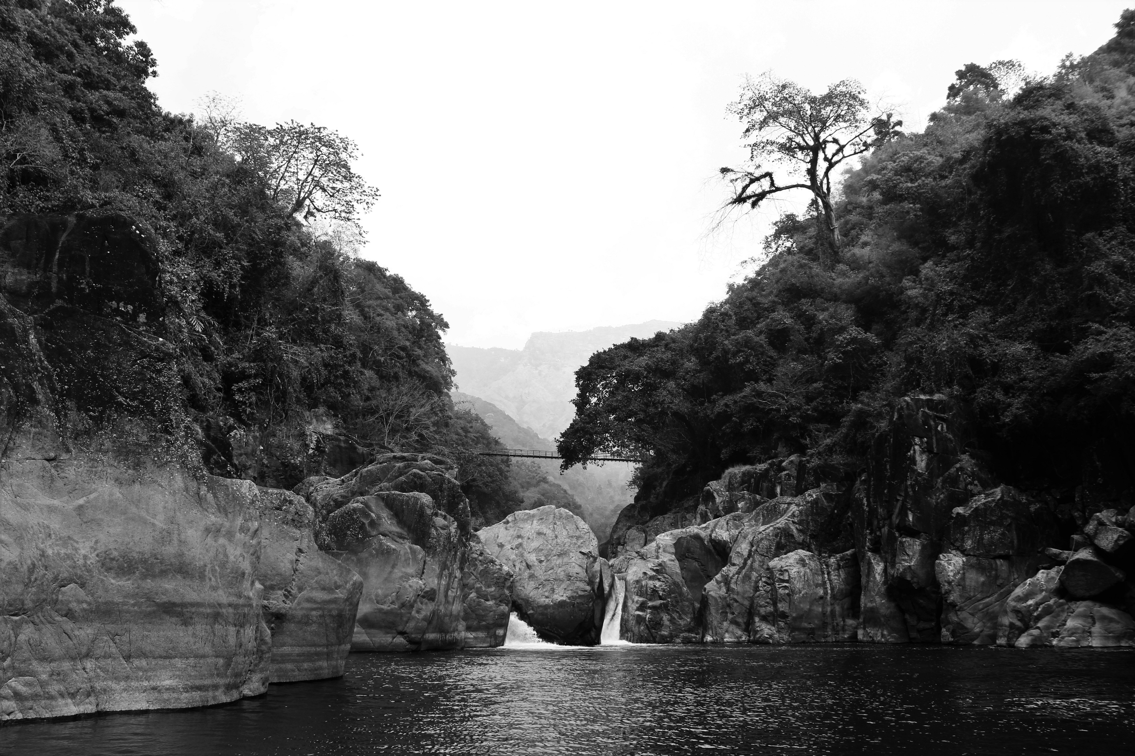
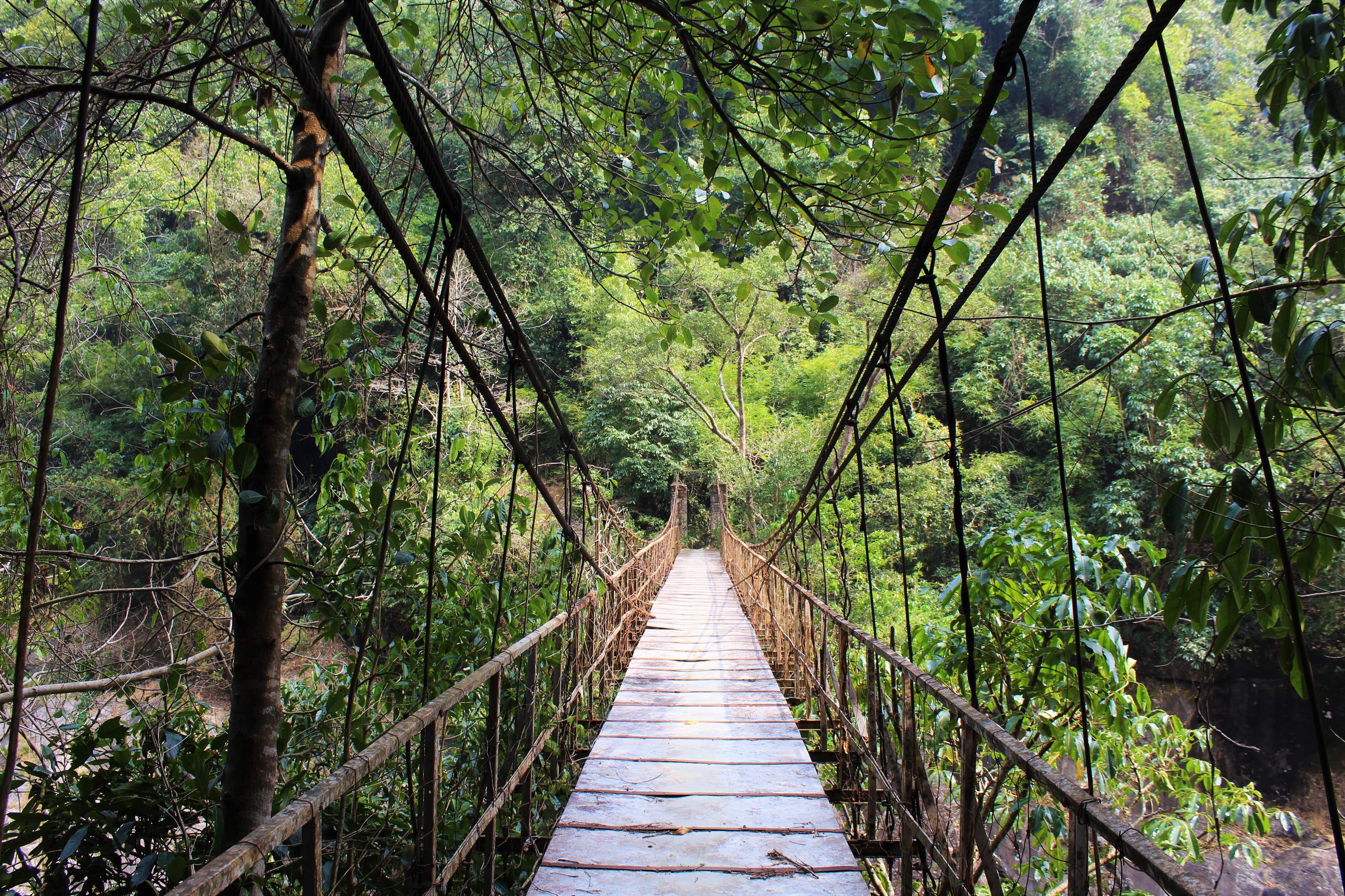
This is a view from downstream of the famous steel bridge at Shnongpdeng Village. It was built to replace an earlier structure which had been situated too close to the river and so was destroyed during a monsoon flood. This is sort of the classic Shnongpdeng image. The Umngot is famous for being both crystal clear and full of fish. Next to Shnongpdeng, there is a long stretch of deep, yet uncharacteristically calm, open water. This has led to the village developing a sort of riverine culture, which is quite unusual in the Khasi Hills. The image above was taken from the middle of the bridge. As I’ve found over the years, the river is vastly deeper than it looks from above. I’d estimate that those folks are in at least five or six feet of water. Boating on the Umngot under the Shnongpdeng suspension bridge. A bridge over the Umsong River, a major tributary of the Umngot. This is along a faint trail between the villages of Nongkwai and Wahlakhiat. My recollection is that the Umsong was, if anything, more crystalline than the Umngot. It was so transparent that fish appeared to be floating above the rocks on the riverbed (sadly, photos just don’t do it justice…at least the ones I had time to take at the midpoint of a brutal canyon trek). I fear that the bridge was in poor condition. This is a bridge over an exceedingly obscure tributary of the Umngot named the Umsi. To my knowledge, this route had never been crossed by a trekker. I don’t rule out the possibility, but the locals were of the opinion that none had come this way before. It’s not hard to see why. The trails in the area are faint and confusing. I got lost in the jungle on the other side on my way up to a village named Mawsna. Long story. As I was trekking in the valley of the Umsi River and through villages on either side, I was told that there was once a living root bridge that spanned the stream. This was reported to have been destroyed in a storm some time ago. My sources varied somewhat on the details, but there seemed to be agreement that the bridge had not existed as of the mid-90s. I was never able to ascertain where exactly the bridge had been located. However, the spot above, at roughly the same location as the steel footbridge, seems a distinct possibility. The tree in the center of the photo is a ficus, and these are generally (though not 100% of the time) only found in the Khasi Hills when they have been planted. It seems logical that the bridge meant to replace the living structure would be situated at roughly the same place. That said, my sojourn in the area was far too brief to find out for certain if this was true or not…It’s still a lovely tree though. This is a rather decrepit bridge over the Rishi River, another tributary of the Umngot, just below a village named Nonghulew. The bridge was in such poor condition when I came across it in 2019 that the locals preferred hopping across the stones of the river to walking over the span. In the monsoon season, of course, this is no longer a possibility. However, it’s unlikely that this bridge, rotting as it is, will see many more monsoons. And, finally, the canyon of the Umngot proper, as spanned by yet another steel suspension bridge. It took quite a bit of rough hiking to get from the bridge down to the huge pool in the foreground…and it was more than worth it. Over the Umngot.


One thought on “SUSPENSION BRIDGES OF MEGHALAYA: PART 3”