
The last thing that comes to my mind when someone brings up the Chesapeake Bay region is violent topography. My mental image of the bay is of wide expanses of salt water bordered by tidal wetlands and suburbs. It’s easy to view the fringes of the Chesapeake as little more than itchy, briny, impenetrable swamps to be avoided at all costs. This attitude isn’t entirely without merit. There are times of year during which the biting flies in the marshes of Southern Delaware and the Eastern Shore of Maryland get so intense that you can’t even step out of your car for five seconds without getting covered in huge bleeding welts (It’s actually kind of a remarkable thing to witness. Everyone should have that happen to them at least once, if only for an interesting experience.)
But as the years have gone by, I’ve come to appreciate the unloved salt marshes of my homeland. They are quite simply exploding with life. Over the course of a solid 90-minute kayak in one of the tidal estuaries on the western side of the Delmarva Peninsula, one can see everything from giant snapping turtles to bald eagles to pairs of otters to families of beavers with big-fat-pregnant-momma beavers practically the size of cows that menacingly swim towards your kayak and smack the surface of the water with their tails to scare the crap out of you.
Make no mistake, there are adventures to be had in the moist weedy thickets of Mid-Atlantic wetlands.
However, what I had always assumed the Chesapeake Bay area lacked was dramatic cliffs and mountains. But then I started going to Elk Neck State Park in Cecil County, Maryland.
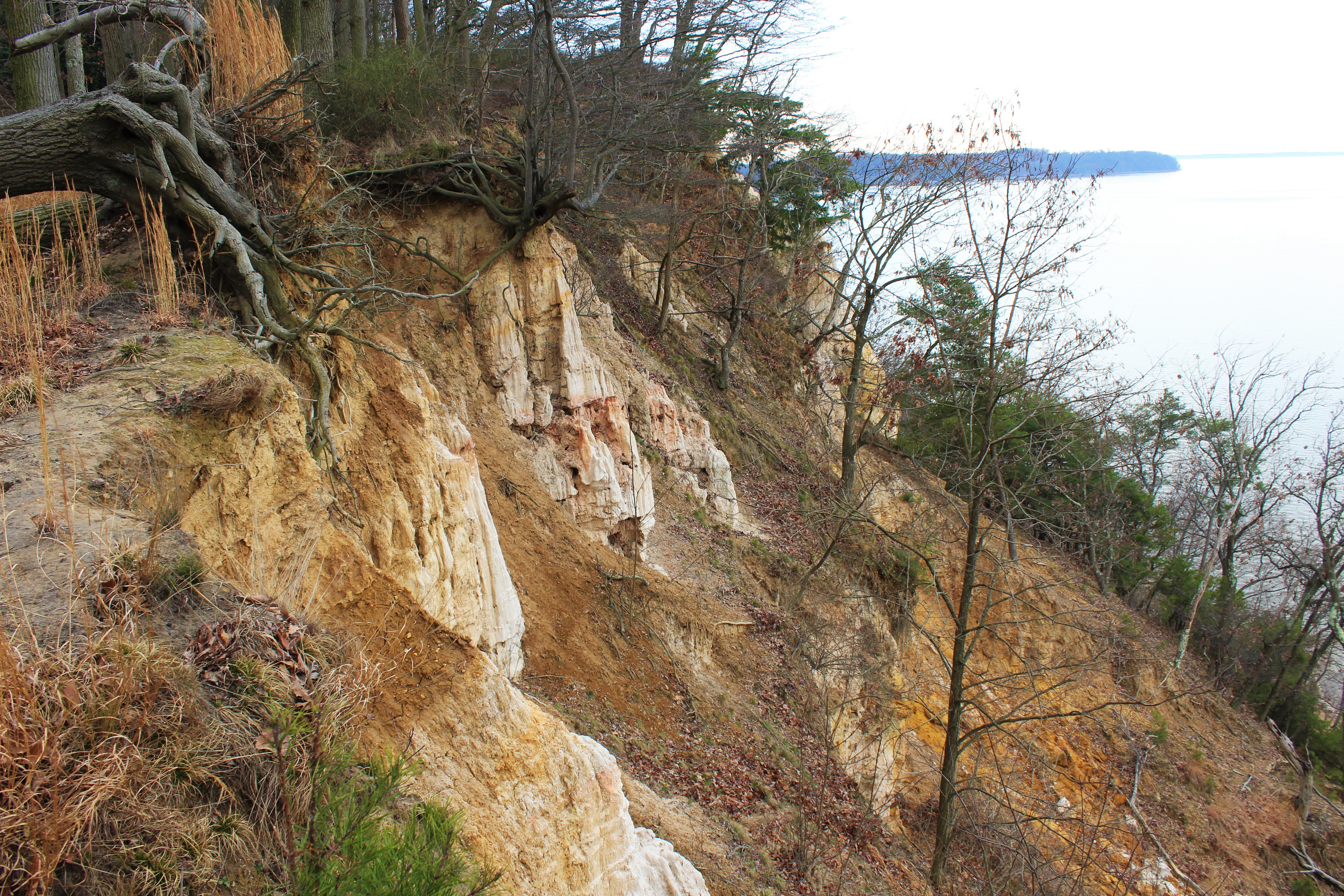
The park occupies the tip of the Elk Neck Peninsula, at the confluence of the Elk River and the Chesapeake Bay. On the swampier eastern side of the Peninsula the terrain is much more in line with what one would expect from the Chesapeake, but from there the land gradually slopes upwards in low, but surprisingly steep, gravel and sand hills. Then, on the side of the Peninsula that faces the Chesapeake, the hills drop off dramatically in steep cliffs.
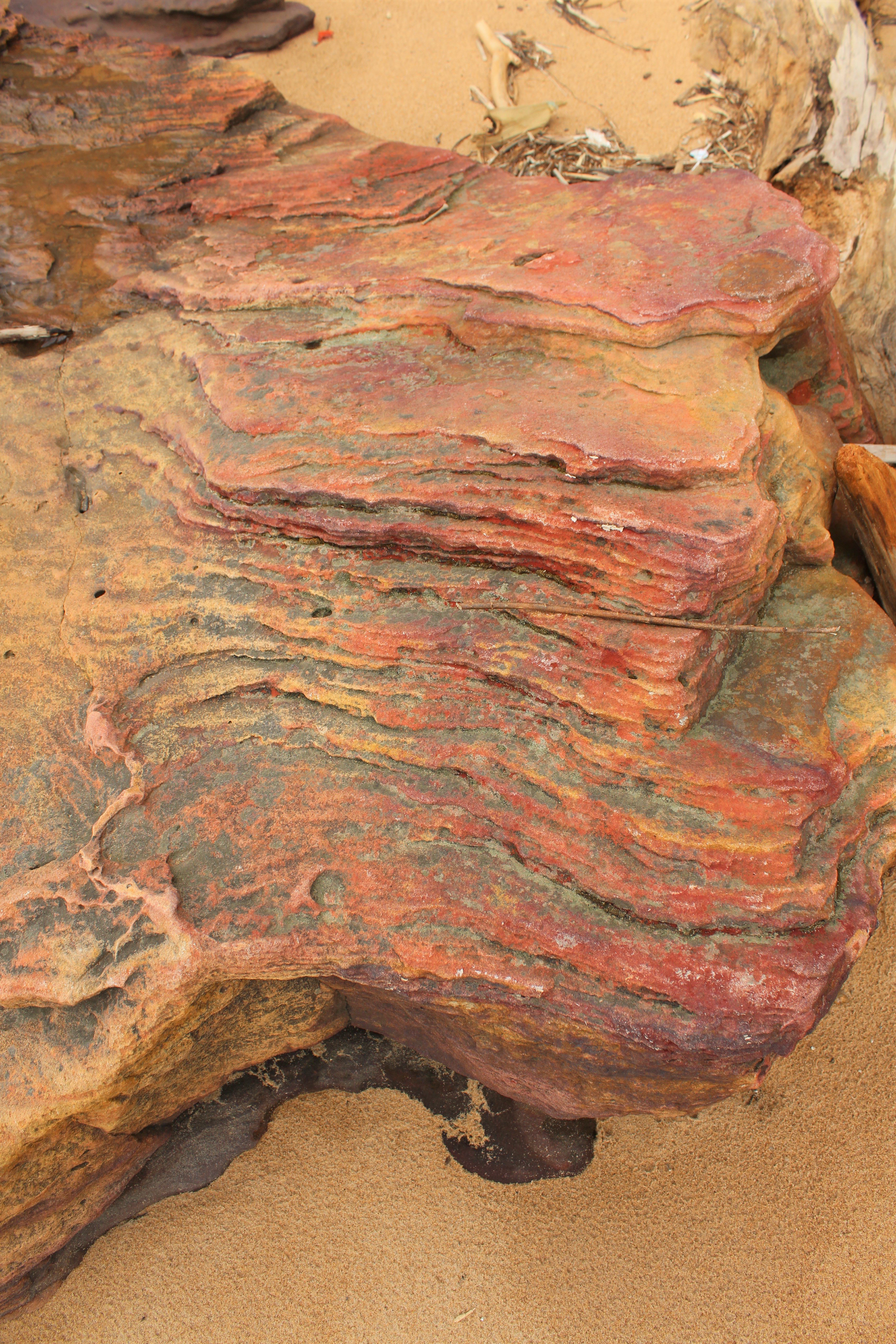
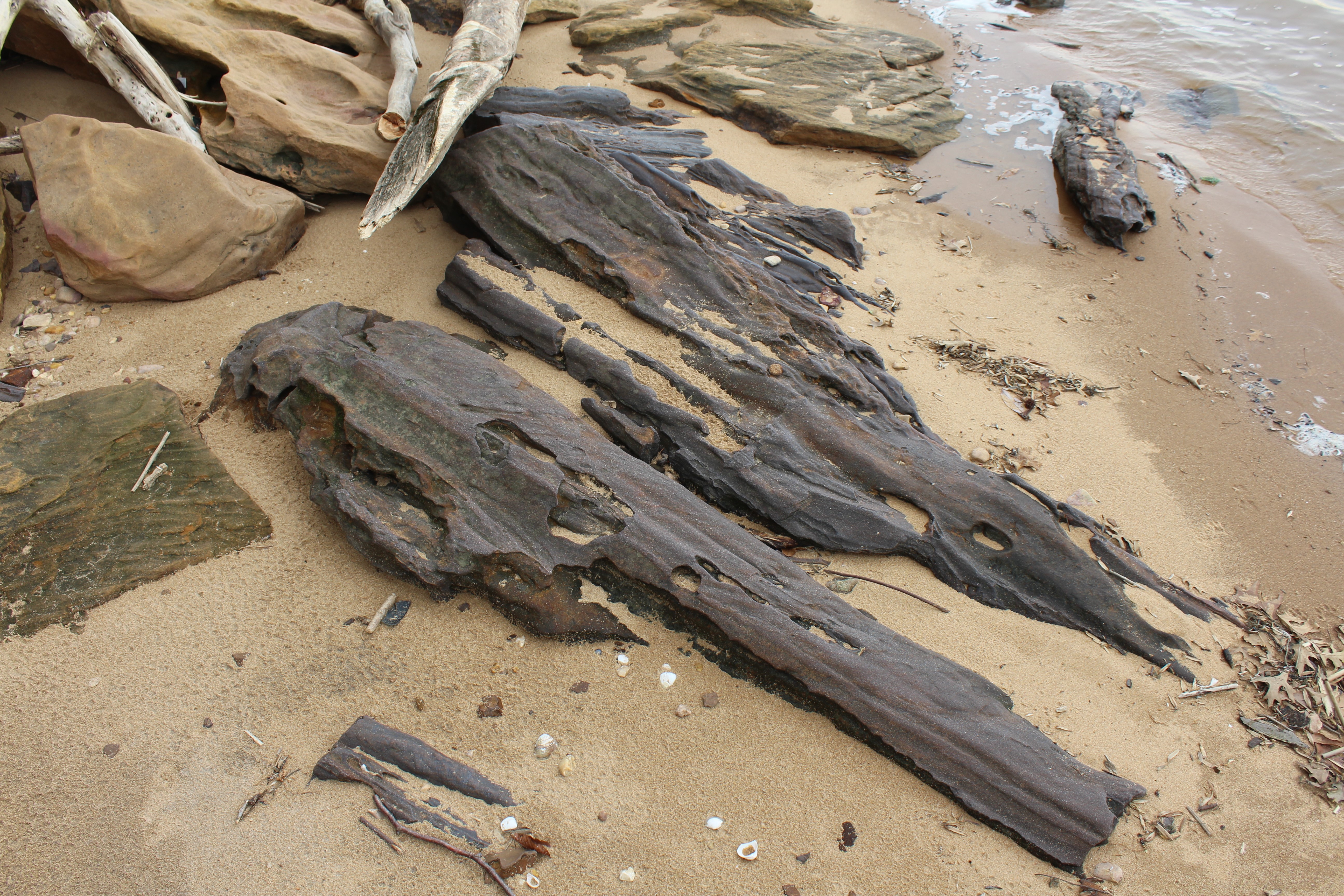
The cliffs, which are made up of loosely consolidated material washed down from the Appalachian piedmont by the Elk and Susquehanna rivers, can only be described as badlands, a landform which one certainly doesn’t associate with the Chesapeake region, or, for that matter, virtually anywhere east of the Mississippi (and, yes, I’m sure there are scattered examples here and there in the East…especially due to harmful early-to-mid 20th century agricultural practices stripping slopes of ground cover…still, natural badlands such as the White Banks are in short supply this side of the Dakotas).
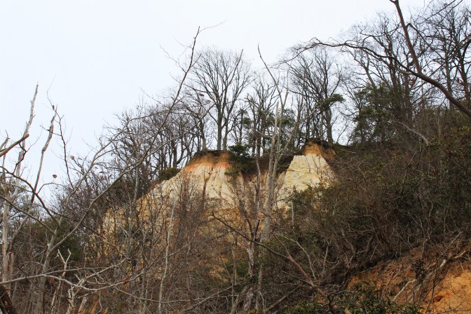
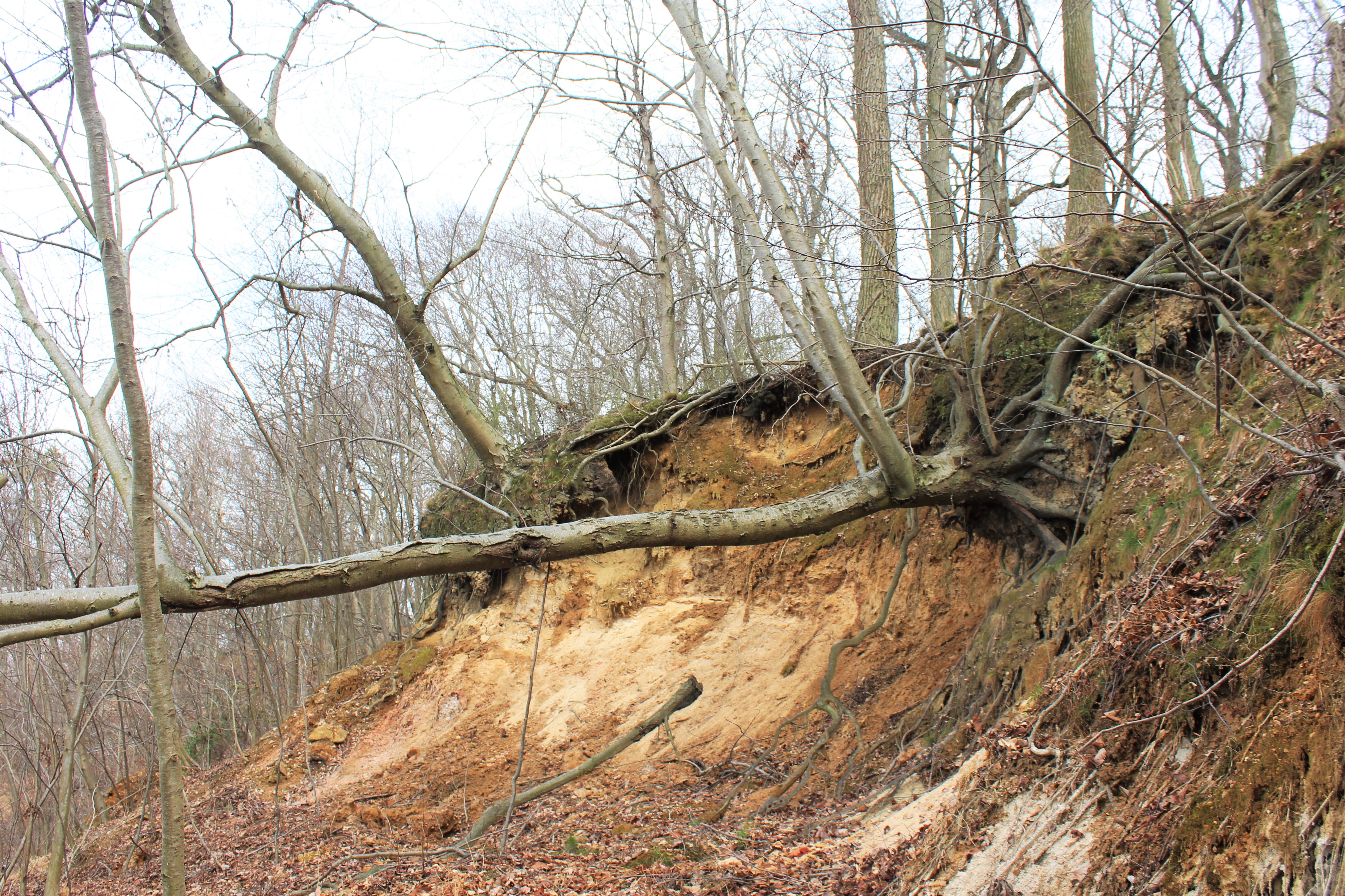
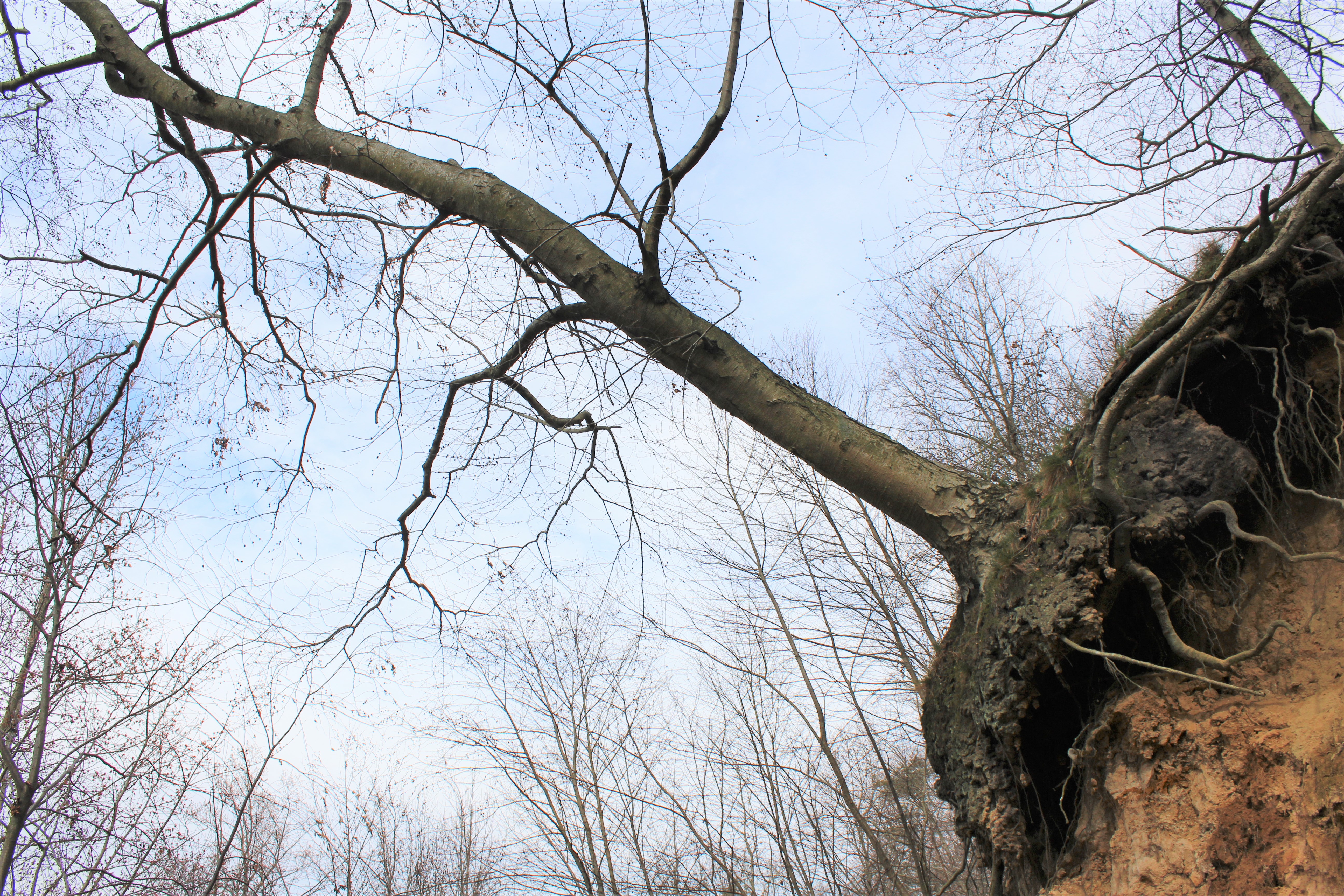
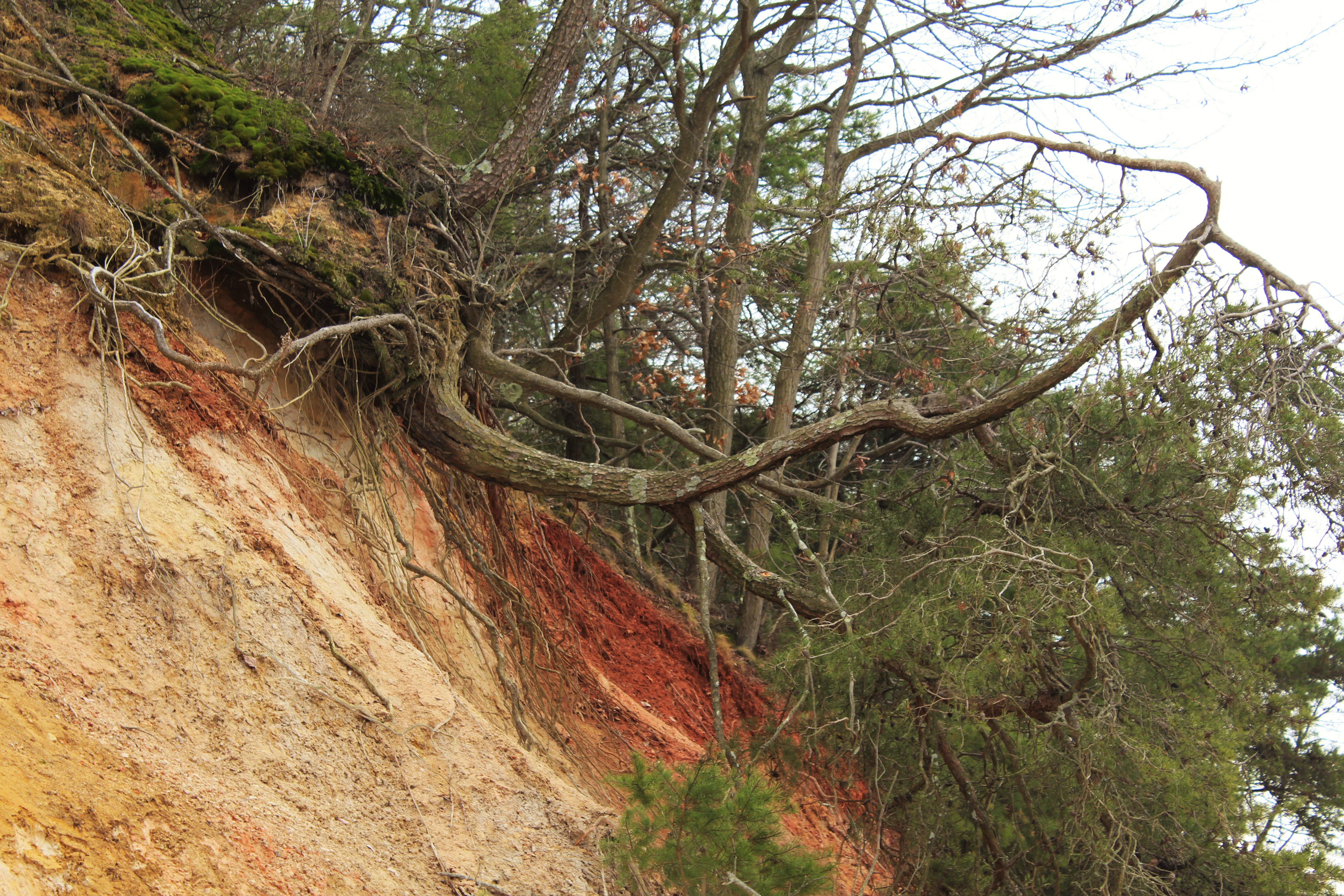
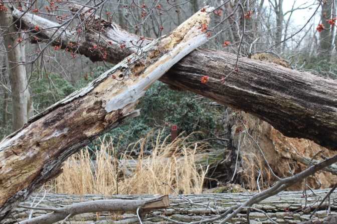
Above: These give you an idea of just how unstable the White Banks are. Though they are covered in dense woodland, much of that woodland is in danger of tumbling over the sides of the quickly eroding cliff-faces. Not that the trees don’t cling to life as long as possible. While the one in the photo on the left is clearly in a precarious situation, note how it’s started to grow branches vertically from near its base. It must have started leaning like that quite some time ago and then remained reasonably healthy despite its change in angle.
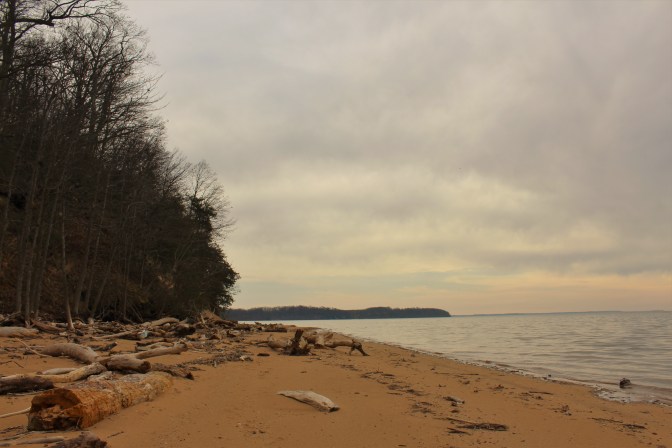
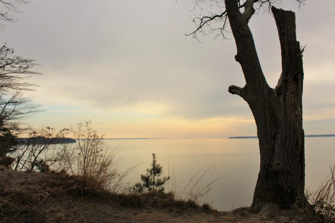
From the White Banks overlook it’s possible to see well out over the upper Chesapeake Bay, from the mouth of the Susquehanna in the north, down to around Howell Point Maryland at the mouth of the Sassafras River. It’s also an incredible place to spot Bald Eagles, particularly in the wintertime. From the overlook, one is often able to see the giant birds patrolling up and down the shoreline below. I’ve seen seven at once.
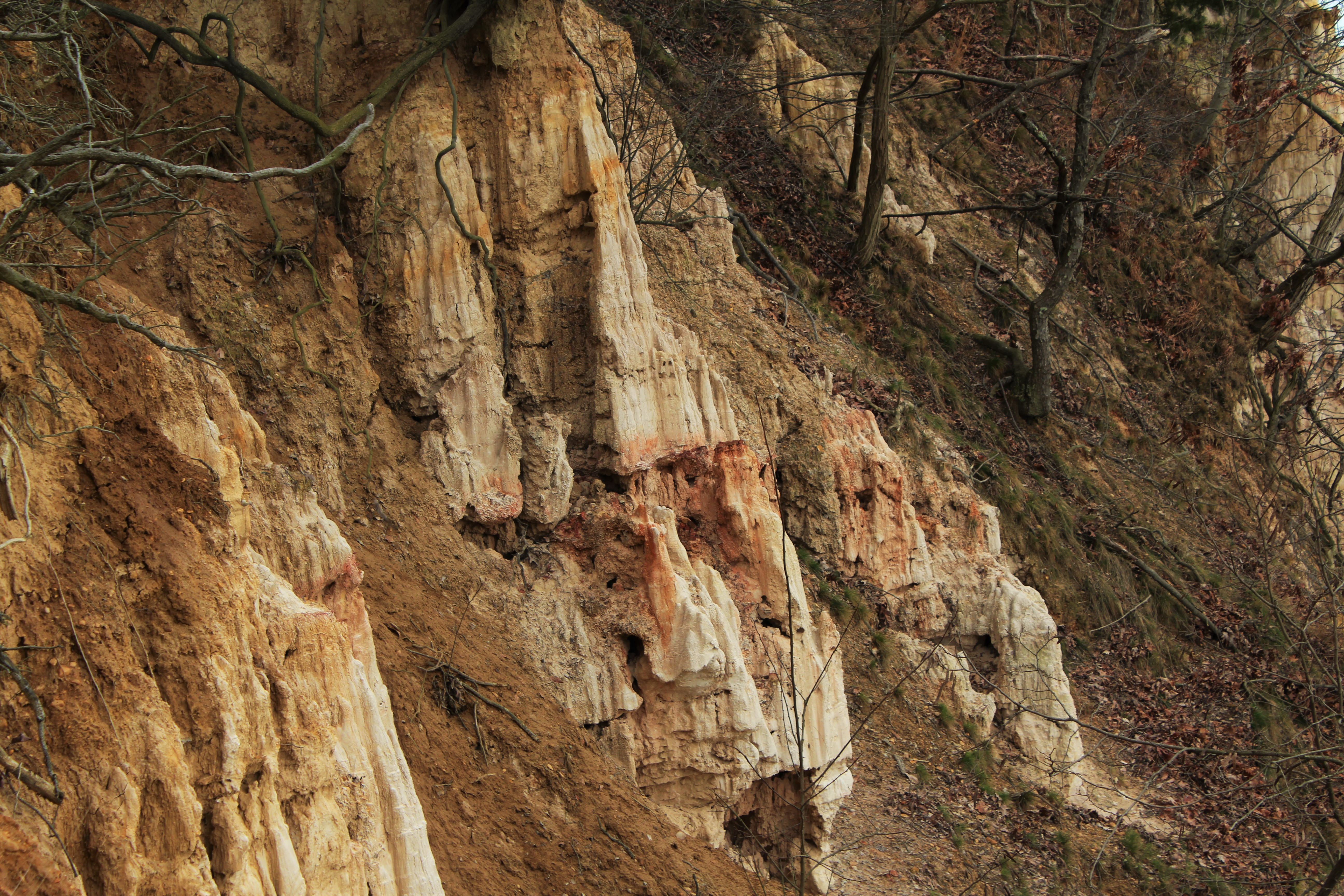
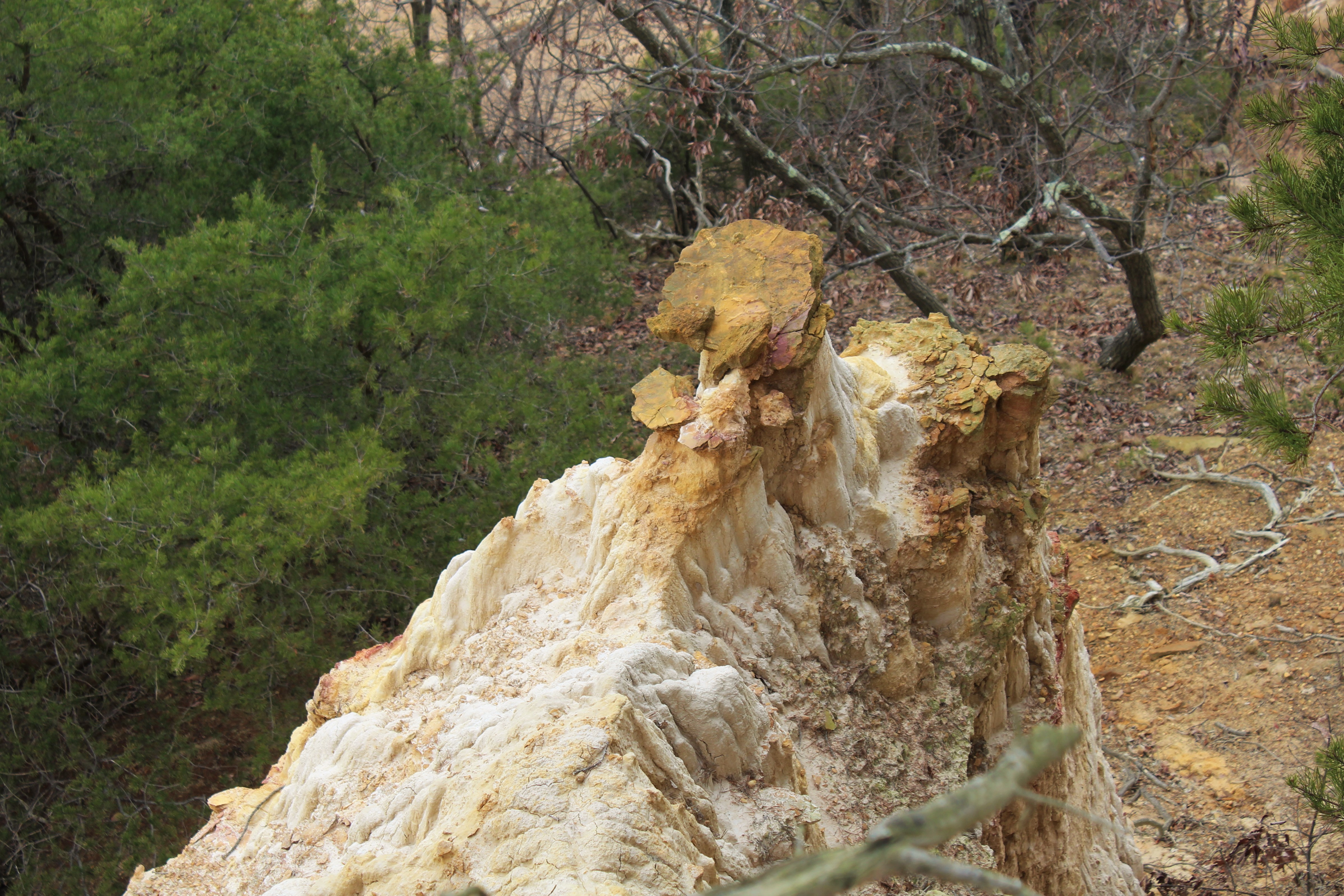
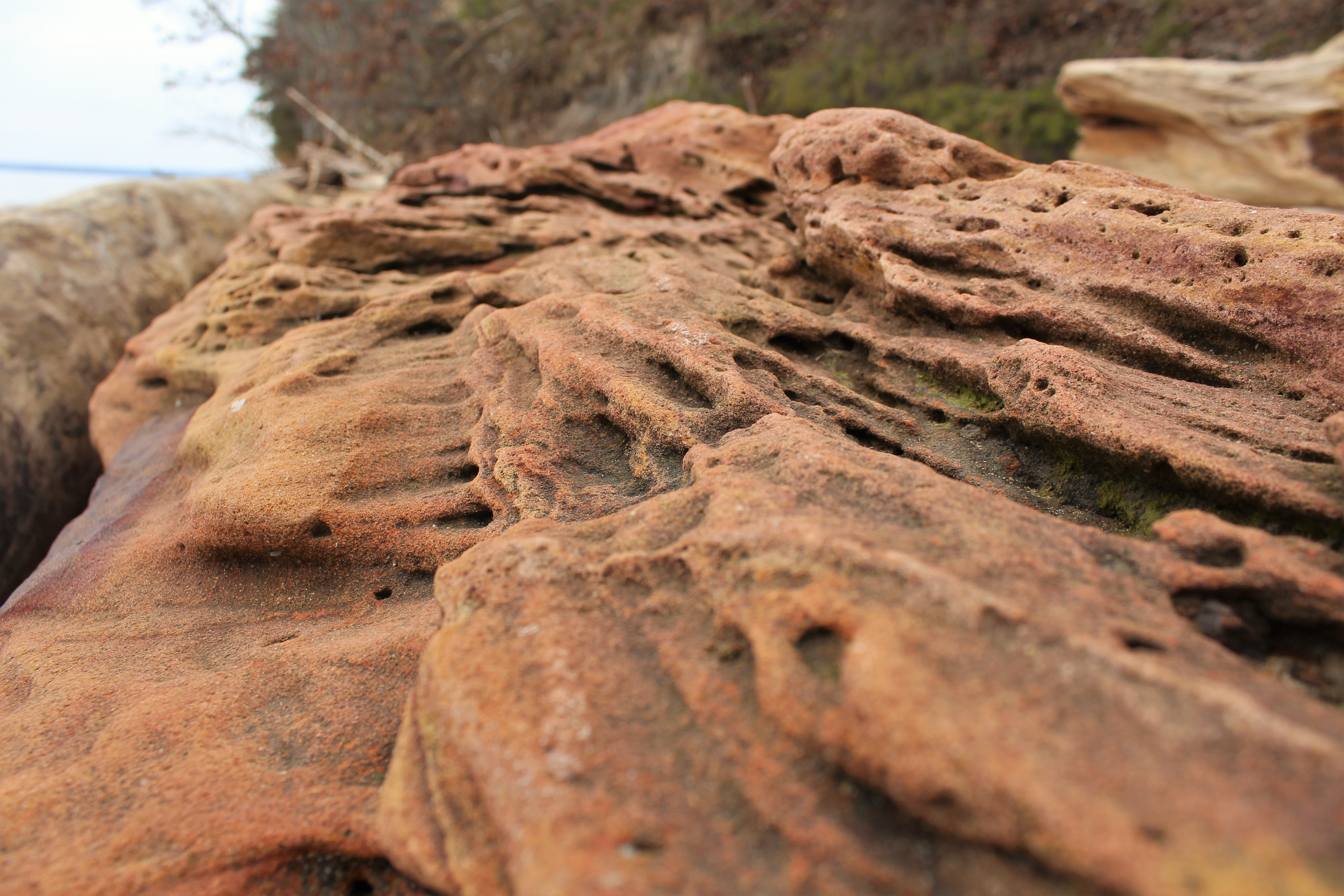
Above: Badlands formations on the edge of the White Banks trail, including what I suspect is the only honest to goodness hoodoo in Cecil County Maryland (on the lower right).
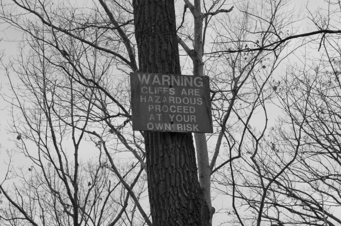
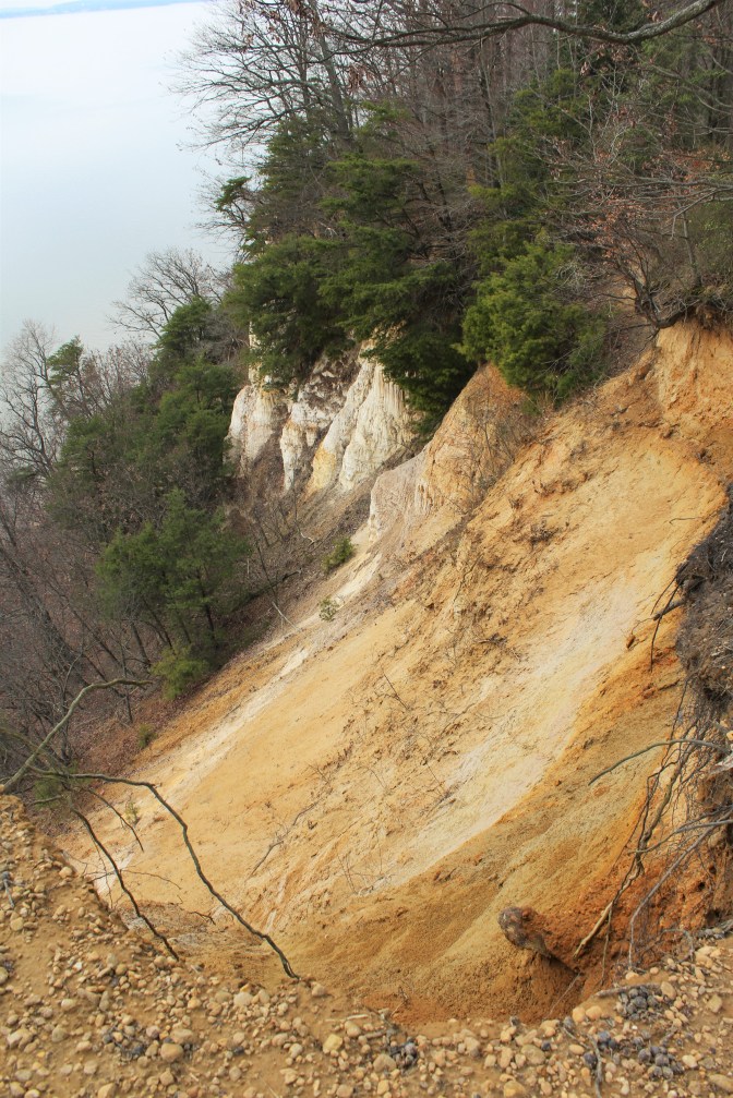
But the overlooks are eroding fast. The tops of the cliffs are little shelves of dirt that protrude from the hillsides and look like they’re going to collapse in the near future. Yes, the cliffs are genuinely hazardous, and at some point somebody is probably going to fall to their deaths from them. I dearly hope that if this comes to pass, the park won’t move to restrict access to the White Banks. After all, the public needs the occasional hazard to stay healthy.
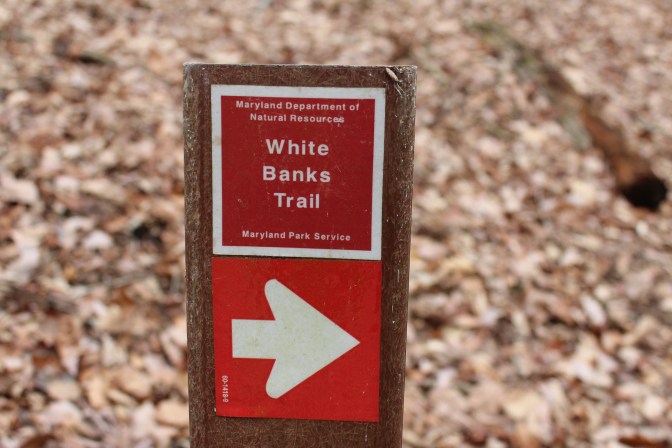
Fortunately, at least as far as people falling to their deaths is concerned, the White Banks are not an especially popular part of Elk Neck State Park. For one, you have to walk a few miles to get to them, on a trail which the park brochure designates as “difficult” …a relative term, though the trail does climb a 200-foot mound of unconsolidated sediment optimistically called Mauldin Mountain, and even features a few switchbacks.
And lately, the trail to reach the White Banks has become even longer. It used to be possible to park at the top of Mauldin Mountain, where there were some picnic tables and a pavilion, but the area has since been closed off due to, of all things, an EF-1 tornado back in 2019.
The tornado is thought to have started as a waterspout in the Chesapeake which then made landfall just north of the White Banks, moving up a ravine on the flank of Mauldin Mountain and then proceeding to cut a third-of-a-mile-wide swath of destruction northeast across the Elk Neck Peninsula. While the tornado wasn’t especially powerful (and didn’t cause any fatalities), it downed hundreds of trees, damaged several buildings, and wrecked a large portion of Elk Neck State Park’s trail network.
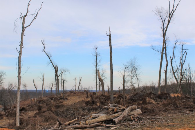
Not only Mauldin Mountain, but a considerable part of Elk Neck State Park have been closed to the public since 2019 for cleanup. The White Banks Trail just opened earlier this year, though some of the trails on the eastern side of the peninsula remain inaccessible.
For more on the White Banks and hiking in Elk Neck State park, check out the Maryland Department of Natural Resources website.
If you enjoyed this post, please consider supporting me on my Patreon page. There, you can download [BEGINNING JULY 2022!] a new extended edition of my book The Green Unknown: Travels in the Khasi Hills which includes several chapters available exclusively on Patreon, as well as access a whole slew of other perks.

One thought on “The White Banks of Elk Neck”